IMAGES TAKEN NEAR TO
Luppitt, HONITON, EX14 4TR
Introduction
This page details the photographs taken nearby to EX14 4TR by members of the Geograph project.
The Geograph project started in 2005 with the aim of publishing, organising and preserving representative images for every square kilometre of Great Britain, Ireland and the Isle of Man.

There are currently over 7.5m images from over14,400 individuals and you can help contribute to the project by visiting https://www.geograph.org.uk
Image Map
Images are licensed for reuse under creativecommons.org/licenses/by-sa/2.0
Notes
- Clicking on the map will re-center to the selected point.
- The higher the marker number, the further away the image location is from the centre of the postcode.
Image Listing (12 Images Found)
Images are licensed for reuse under creativecommons.org/licenses/by-sa/2.0
Image
Details
Distance
1
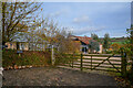
Luppitt : Smithenhayes Farm
Looking beyond the gate to Smithenhayes Farm.
Image: © Lewis Clarke
Taken: 13 Nov 2020
0.04 miles
3
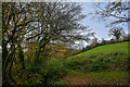
Luppitt : Grassy Field
A grassy field in the countryside.
Image: © Lewis Clarke
Taken: 13 Nov 2020
0.05 miles
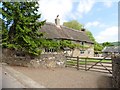
4
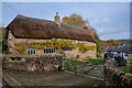
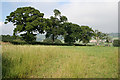
Luppitt : Smithenhayes Farmhouse
Smithenhayes is an attractive, interesting and well-preserved farmhouse.
Image: © Lewis Clarke
Taken: 13 Nov 2020
0.05 miles
5
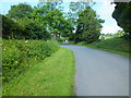
The Road to Beacon, Luppitt, Devon
Looking north outside Whitehall Farm
Image: © Raymond Cubberley
Taken: 23 Jun 2011
0.07 miles
6
Luppitt: near Whitehall Farm
A view towards the Otter valley, looking north east
Image: © Martin Bodman
Taken: 28 Jun 2006
0.10 miles
7
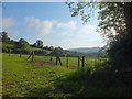
Grazing Field,Whitehall Farm,Luppitt, Devon
These fields are mainly for Horse Grazing
Image: © Raymond Cubberley
Taken: 23 Jun 2011
0.11 miles
8
Luppitt : Track
A track to Whitehall Farm.
Image: © Lewis Clarke
Taken: 13 Nov 2020
0.12 miles
9
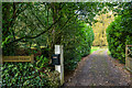
Luppitt : Track
A track heads to Halsdon House.
Image: © Lewis Clarke
Taken: 13 Nov 2020
0.16 miles
10
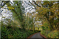
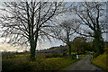
Luppitt : Country Lane
A small lane heads through the countryside.
Image: © Lewis Clarke
Taken: 13 Nov 2020
0.17 miles