IMAGES TAKEN NEAR TO
Dunkeswell, HONITON, EX14 4TB
Introduction
This page details the photographs taken nearby to EX14 4TB by members of the Geograph project.
The Geograph project started in 2005 with the aim of publishing, organising and preserving representative images for every square kilometre of Great Britain, Ireland and the Isle of Man.

There are currently over 7.5m images from over14,400 individuals and you can help contribute to the project by visiting https://www.geograph.org.uk
Image Map
Images are licensed for reuse under creativecommons.org/licenses/by-sa/2.0
Notes
- Clicking on the map will re-center to the selected point.
- The higher the marker number, the further away the image location is from the centre of the postcode.
Image Listing (13 Images Found)
Images are licensed for reuse under creativecommons.org/licenses/by-sa/2.0
Image
Details
Distance
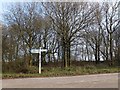
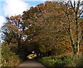
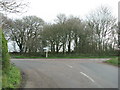
4
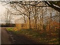
Late sun at Ewin's Ash
Greenway Lane reaches the staggered crossroads on the plateau road between Limers Cross and Smeatharpe.
Image: © Derek Harper
Taken: 26 Jan 2012
0.17 miles
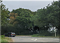
5
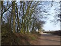
Road to Ewin's Ash
Seen from where the road crosses the Rhododendron Wood
Image: © David Smith
Taken: 4 Mar 2013
0.17 miles
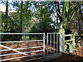
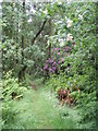
9
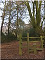
Start of the Rhododendron Walk
A woodland path that runs through the long (about 1km) narrow wood
Image: © David Smith
Taken: 4 Mar 2013
0.19 miles