IMAGES TAKEN NEAR TO
Buckerell, HONITON, EX14 3QD
Introduction
This page details the photographs taken nearby to EX14 3QD by members of the Geograph project.
The Geograph project started in 2005 with the aim of publishing, organising and preserving representative images for every square kilometre of Great Britain, Ireland and the Isle of Man.

There are currently over 7.5m images from over14,400 individuals and you can help contribute to the project by visiting https://www.geograph.org.uk
Image Map
Images are licensed for reuse under creativecommons.org/licenses/by-sa/2.0
Notes
- Clicking on the map will re-center to the selected point.
- The higher the marker number, the further away the image location is from the centre of the postcode.
Image Listing (6 Images Found)
Images are licensed for reuse under creativecommons.org/licenses/by-sa/2.0
Image
Details
Distance


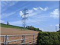
3
Power in the fields
Pylons march across green fields.
Image: © Anthony Vosper
Taken: 6 May 2021
0.07 miles
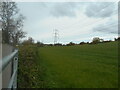
4
Field and power lines near Deer Park Farm
Image: © Rob Purvis
Taken: 8 May 2022
0.07 miles
5
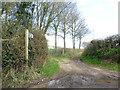
Tape Lane
A small trackway leading to Weston Lane in the east.
Image: © Anthony Vosper
Taken: 6 May 2021
0.11 miles