
IMAGES TAKEN NEAR TO
Payhembury, HONITON, EX14 3EZ
Introduction
This page details the photographs taken nearby to EX14 3EZ by members of the Geograph project.
The Geograph project started in 2005 with the aim of publishing, organising and preserving representative images for every square kilometre of Great Britain, Ireland and the Isle of Man.

There are currently over 7.5m images from over14,400 individuals and you can help contribute to the project by visiting https://www.geograph.org.uk
Image Map
Images are licensed for reuse under creativecommons.org/licenses/by-sa/2.0
Notes
- Clicking on the map will re-center to the selected point.
- The higher the marker number, the further away the image location is from the centre of the postcode.
Image Listing (62 Images Found)
Images are licensed for reuse under creativecommons.org/licenses/by-sa/2.0
Image
Details
Distance
2

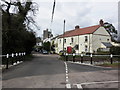
Payhembury : Road
A road and a stream heading through Payhembury.
Image: © Lewis Clarke
Taken: 9 May 2018
0.01 miles
3
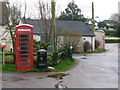
Payhembury: redundant phone box
A traditional red telephone box stands between a bus stop sign and a litter bin, but has had its telephone apparatus removed.
Image: © Chris Downer
Taken: 7 Mar 2013
0.02 miles
4
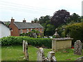
View of houses from churchyard
The lantern marks the entrance to the church grounds.
Image: © Ruth Sharville
Taken: 25 May 2009
0.02 miles
5
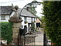
Thirst after righteousness...the pub next to the church
Image: © Ruth Sharville
Taken: 25 May 2009
0.02 miles
6
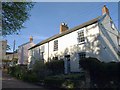
Cottages, Payhembury
Of this pair of semi-detached cottages on the hill below the green, Rose Cottage (left, http://www.britishlistedbuildings.co.uk/en-86864-rose-cottage-payhembury ) has margin panes (see also Image) while Charwood (right, http://www.britishlistedbuildings.co.uk/en-86865-charwood-payhembury ) doesn't.
Image: © Derek Harper
Taken: 6 Apr 2011
0.02 miles
7
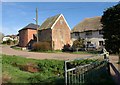
Granary and other buildings, Payhembury
The square granary carries the date 1780 http://www.britishlistedbuildings.co.uk/en-86857-church-of-st-mary-payhembury . To its right is Lower House, a thatched farmhouse dating back to at least the C16 http://www.britishlistedbuildings.co.uk/en-86866-lower-house-including-rear-garden-walls-p . In the foreground is a tributary of the River Tale; the bridge also appears in Image
Image: © Derek Harper
Taken: 6 Apr 2011
0.02 miles
8
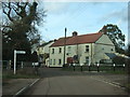
Bridge in Payhembury
A bridge over a small stream in the village.
Image: © David Smith
Taken: 3 Feb 2011
0.03 miles
9
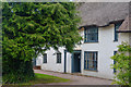
Payhembury : The Lower House
Looking towards The Lower House in Payhembury.
Image: © Lewis Clarke
Taken: 9 May 2018
0.03 miles
10
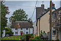
Payhembury : Village Scenery
Looking through Payhembury.
Image: © Lewis Clarke
Taken: 9 May 2018
0.03 miles