
IMAGES TAKEN NEAR TO
Orchard Way, HONITON, EX14 1HU
Introduction
This page details the photographs taken nearby to Orchard Way, EX14 1HU by members of the Geograph project.
The Geograph project started in 2005 with the aim of publishing, organising and preserving representative images for every square kilometre of Great Britain, Ireland and the Isle of Man.

There are currently over 7.5m images from over14,400 individuals and you can help contribute to the project by visiting https://www.geograph.org.uk
Image Map
Images are licensed for reuse under creativecommons.org/licenses/by-sa/2.0
Notes
- Clicking on the map will re-center to the selected point.
- The higher the marker number, the further away the image location is from the centre of the postcode.
Image Listing (315 Images Found)
Images are licensed for reuse under creativecommons.org/licenses/by-sa/2.0
Image
Details
Distance
1

St Michael's Day Centre, Orchard Way, Honiton
A Devon County Council day centre for senior citizens.
Image: © Jaggery
Taken: 1 Aug 2017
0.01 miles
2
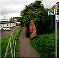
Queen Elizabeth II postbox alongside a public footpath in Honiton
St Michael's Day Centre http://www.geograph.org.uk/photo/5619741 is on the left.
Image: © Jaggery
Taken: 1 Aug 2017
0.02 miles
3
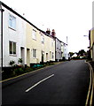
Queen Street houses, Honiton
On the north side of Queen Street on the ascent towards Orchard Way.
Image: © Jaggery
Taken: 1 Aug 2017
0.03 miles
4

Junction of Orchard Way and Queen Street, Honiton
Orchard Way is on the camera side and ahead. Queen Street on the right leads to New Street.
Image: © Jaggery
Taken: 1 Aug 2017
0.03 miles
5
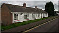
Row of three bungalows, Orchard Way, Honiton
Originally, bungalow was used in English for a lightly-built house, with a veranda and one storey.
In current UK usage it is a convenient word for any one-storey dwelling.
Image: © Jaggery
Taken: 1 Aug 2017
0.03 miles
7

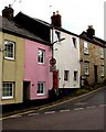
No motor vehicles signs, Queen Street, Honiton
The signs are qualified by text showing Except for access to Queen Street (numbers 32-60), Orchard Way, Westcott Way.
Image: © Jaggery
Taken: 1 Aug 2017
0.05 miles
8
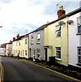
West down Queen Street, Honiton
Towards New Street. Double yellow lines on both sides of Queen Street indicate no parking at any time.
Image: © Jaggery
Taken: 1 Aug 2017
0.05 miles
9
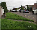
On-street parking, Orchard Way, Honiton
Orchard Way leads to Westcott Way. The path through grass leads to a row of three bungalows. http://www.geograph.org.uk/photo/5619733
Image: © Jaggery
Taken: 1 Aug 2017
0.05 miles
10

Chapel Street, Honiton
Dead-end street extending for 90 metres from the east side of New Street.
Image: © Jaggery
Taken: 1 Aug 2017
0.05 miles