
IMAGES TAKEN NEAR TO
Florence Way, EXETER, EX1 3FW
Introduction
This page details the photographs taken nearby to Florence Way, EX1 3FW by members of the Geograph project.
The Geograph project started in 2005 with the aim of publishing, organising and preserving representative images for every square kilometre of Great Britain, Ireland and the Isle of Man.

There are currently over 7.5m images from over14,400 individuals and you can help contribute to the project by visiting https://www.geograph.org.uk
Image Map
Images are licensed for reuse under creativecommons.org/licenses/by-sa/2.0
Notes
- Clicking on the map will re-center to the selected point.
- The higher the marker number, the further away the image location is from the centre of the postcode.
Image Listing (38 Images Found)
Images are licensed for reuse under creativecommons.org/licenses/by-sa/2.0
Image
Details
Distance
1

Florence Way, Exeter
Part of a 21st century housing estate
Image: © David Smith
Taken: 21 Nov 2020
0.03 miles
2

Path near the Met Office
A cycle and footpath from Fitzroy Road to Hill Barton Road. I've a hunch that the barriers mean that the adjacent field won't remain a field for long, and a little research suggests that this could be the site for 750 new homes.
Image: © Derek Harper
Taken: 21 Feb 2016
0.03 miles
3

Melrose Avenue, Exeter
Part of a housing estate developed in the 21st century
Image: © David Smith
Taken: 21 Nov 2020
0.04 miles
4

Path near the Met Office
Image: © Derek Harper
Taken: 8 Jun 2016
0.05 miles
5
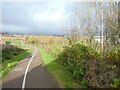
Cycle path on edge of Exeter
This runs between a housing estate on the left and the Met Office
Image: © David Smith
Taken: 21 Nov 2020
0.05 miles
6

Cycle path from Whipton to Sowton
This route links to the Met Office as a commuter route to there and other buildings on the Sowton estates
Image: © David Smith
Taken: 21 Nov 2020
0.06 miles
7

Eastern edge of a housing estate, Whipton in Exeter
The dome just left of centre is a weather radar system for the Met Office
Image: © David Smith
Taken: 21 Nov 2020
0.06 miles
8
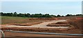
Development at Hill Barton Vale
Houses are under construction at the western end of the new development at Hill Barton Vale; here are the road layouts, seen from the path / cycle route between Hill Barton Road and Fitzroy Road.
Image: © Derek Harper
Taken: 8 Jun 2016
0.07 miles
9
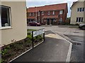
Linton Road junction with Myrtlebury Way
Image: © Rob Purvis
Taken: 18 May 2018
0.07 miles
10

Footpath into housing estate, east edge of Exeter
Image: © David Smith
Taken: 21 Nov 2020
0.08 miles