IMAGES TAKEN NEAR TO
Shute, AXMINSTER, EX13 7QJ

Introduction

This page details the photographs taken nearby to EX13 7QJ by members of the Geograph project.

The Geograph project started in 2005 with the aim of publishing, organising and preserving representative images for every square kilometre of Great Britain, Ireland and the Isle of Man.

There are currently over 7.5m images from over14,400 individuals and you can help contribute to the project by visiting https://www.geograph.org.uk

Image Map


Images are licensed for reuse under creativecommons.org/licenses/by-sa/2.0
Notes
  • Clicking on the map will re-center to the selected point.
  • The higher the marker number, the further away the image location is from the centre of the postcode.

Image Listing (16 Images Found)

Images are licensed for reuse under creativecommons.org/licenses/by-sa/2.0
Image
Details
Distance
1
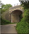
Railway bridge, Umborne
This bridge by Patches Farm is BAE2 E4/457 on the Waterloo-Exeter line.
Image: © Derek Harper Taken: 28 Aug 2012
0.05 miles
2
Nameplate and postbox, railway bridge, Patches
Confirmation that Image is BAE2 E4/457. The Victorian postbox is EX13 20.
Image: © Derek Harper Taken: 28 Aug 2012
0.05 miles
3
Railway bridge on Coxley Lane
Image: © Roger Cornfoot Taken: 8 Nov 2017
0.05 miles
4
Umborne Brook valley
Looking across the flood plain from the lane near Patches Farm. Shute Footpath 11 leaves the lane at this point, turning to the right to cross the river. On the left is Big Umbourne.
Image: © Derek Harper Taken: 28 Aug 2012
0.06 miles
5
Umborne Brook
Looking upstream from the footbridge shown in Image, with meadows on either side.
Image: © Derek Harper Taken: 28 Aug 2012
0.12 miles
6
Road closed
The message seems superfluous, as surely no one in their right mind would try and drive a vehicle along this track between Little and Big Umborne (background) supposing it to be a road. Doubtless it was once. Progress along it is straightforward for the walker and involves a footbridge across the Umborne Brook.
Image: © Derek Harper Taken: 28 Aug 2012
0.13 miles
7
Cottage on Coxley Lane
Image: © Roger Cornfoot Taken: 8 Nov 2017
0.13 miles
8
Woodend Park
Image: © N Chadwick Taken: 29 Mar 2015
0.14 miles
9
Footbridge over Umborne Brook
The footbridge is beside a theoretical ford on the "closed road" shown in Image The river is flowing to the right.
Image: © Derek Harper Taken: 28 Aug 2012
0.14 miles
10
Footbridge over Umborne Brook
Looking along the footbridge shown in Image The green lane continues to Little Umbourne.
Image: © Derek Harper Taken: 28 Aug 2012
0.14 miles