IMAGES TAKEN NEAR TO
Park View, AXMINSTER, EX13 7PS
Introduction
This page details the photographs taken nearby to Park View, EX13 7PS by members of the Geograph project.
The Geograph project started in 2005 with the aim of publishing, organising and preserving representative images for every square kilometre of Great Britain, Ireland and the Isle of Man.

There are currently over 7.5m images from over14,400 individuals and you can help contribute to the project by visiting https://www.geograph.org.uk
Image Map
Images are licensed for reuse under creativecommons.org/licenses/by-sa/2.0
Notes
- Clicking on the map will re-center to the selected point.
- The higher the marker number, the further away the image location is from the centre of the postcode.
Image Listing (50 Images Found)
Images are licensed for reuse under creativecommons.org/licenses/by-sa/2.0
Image
Details
Distance
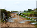
1
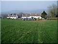
Park View, Shute Road
Parehayne Hill can be viewed on the horizon.
Image: © Peter Holmes
Taken: 20 Mar 2009
0.02 miles
2
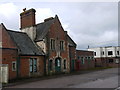
Seaton Junction Station Building
Looking a bit sad, but in basically good condition. Note the old dairy buildings on the right.
Image: © John Lindsay
Taken: 31 Mar 2010
0.10 miles
3
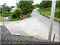
Shute Road near Seaton Junction
An identical view to Image, taken from the east end of the footbridge shown in Image That's postbox EX13 15.
Image: © Derek Harper
Taken: 5 Dec 2012
0.11 miles
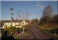
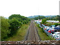
5
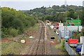
Once Seaton Junction change here no more.
Once a busy junction station with four tracks , sidings and a milk siding. Now just a single track line. This is the view from the public footbridge looking west towards Honiton and Exeter.
Image: © roger geach
Taken: 11 Oct 2009
0.13 miles
6
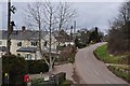
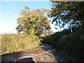
East Devon : Shute Road
Looking along Shute Road and surrounding houses.
Image: © Lewis Clarke
Taken: 16 Feb 2012
0.13 miles
7
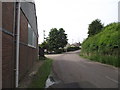
Looking North up Shute Road
Taken from the now disused and derelict Seaton Junction railway station.
Image: © Anthony Vosper
Taken: 10 Jun 2016
0.14 miles
8
Channel to Channel (75)
The footbridge reaches Shute Road.
Another view is at http://www.geograph.org.uk/photo/2808708.
Image: © Shazz
Taken: 14 Sep 2014
0.14 miles
9
Channel to Channel (79)
The footpath is now on a farm track.
Image: © Shazz
Taken: 14 Sep 2014
0.14 miles
10
Channel to Channel (73)
This view along the railway line shows the pedestrian crossing at the railside works.
See an earlier view without the crossing at http://www.geograph.org.uk/photo/2808709.
Image: © Shazz
Taken: 14 Sep 2014
0.15 miles