IMAGES TAKEN NEAR TO
Smallridge, AXMINSTER, EX13 7JH

Introduction

This page details the photographs taken nearby to EX13 7JH by members of the Geograph project.

The Geograph project started in 2005 with the aim of publishing, organising and preserving representative images for every square kilometre of Great Britain, Ireland and the Isle of Man.

There are currently over 7.5m images from over14,400 individuals and you can help contribute to the project by visiting https://www.geograph.org.uk

Image Map


Images are licensed for reuse under creativecommons.org/licenses/by-sa/2.0
Notes
  • Clicking on the map will re-center to the selected point.
  • The higher the marker number, the further away the image location is from the centre of the postcode.

Image Listing (9 Images Found)

Images are licensed for reuse under creativecommons.org/licenses/by-sa/2.0
Image
Details
Distance
1
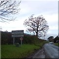
The entrance to Smallridge
A village sign and information board on the south of the village
Image: © David Smith Taken: 28 Dec 2013
0.07 miles
2
Weir above Weycroft Mill
Image: © Andy Phillips Taken: 21 Oct 2003
0.14 miles
3
Unnamed stream, Smallridge
A lovely September afternoon to be on the footbridge here.
Image: © Jonathan Billinger Taken: 14 Sep 2022
0.16 miles
4
Cow field at the back of the Ridgeway Inn at Smallridge
Image: © David Medcalf Taken: 22 Apr 2017
0.16 miles
5
Converted Chapel, Smallridge
Designed to resemble Noah's Ark, a very early Methodist Chapel dating to 1796 which was closed in 2002 and is now a comfortable holiday let.
Image: © Jonathan Billinger Taken: 16 Sep 2022
0.19 miles
6
Watery Lane
A newly-leaved oak stands above the laneside hedge.
Image: © Derek Harper Taken: 25 May 2013
0.22 miles
7
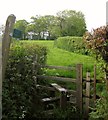
Footpath to Smallridge
All Saints Footpath 66 crosses this stile from Watery Lane and climbs past the group of trees.
Image: © Derek Harper Taken: 25 May 2013
0.23 miles
8
Stile and footpath, leading north from Watery Lane
Image: © Roger Cornfoot Taken: 25 Jul 2018
0.23 miles
9
Watery Lane
As in Image, running roughly parallel to a power line.
Image: © Derek Harper Taken: 25 May 2013
0.24 miles