1
A35 towards Axminster
Image: © Robin Webster
Taken: 7 Sep 2019
0.01 miles
2
House next to the A35, heading towards Axminster
Image: © Rob Purvis
Taken: 2 Feb 2023
0.01 miles
3
A35 on the edge of Shute Hill
The A35 follows a contour round the north side of Shute Hill, through the woods seen here, and then follows the north-east side of the hill to Kilmington
Image: © David Smith
Taken: 15 Jan 2014
0.02 miles
4
Looking SW on the A35 near Kilmington
Image: © M Etherington
Taken: 9 May 2007
0.04 miles
5
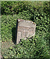
Old stone milepost on the A35
A well-worn milepost 6 miles from Honiton and 3 miles from Axminster.
To see some 360°Panoramas of Devon please visit this http://www.360panoramas.co.uk
Image: © M Etherington
Taken: 9 May 2007
0.06 miles
6
Looking NE on the A35 near Kilmington
Image: © M Etherington
Taken: 9 May 2007
0.06 miles
7
Farmland near Kilmington
Image: © M Etherington
Taken: 9 May 2007
0.06 miles
8
Old Milestone by the A35, north of Shute
Metal plate attached to stone post by the A35, in parish of SHUTE (EAST DEVON District), 200m South of Lobelia House, on grass verge, very close to road edge, on South side of road. Axminster T-iron plate, erected by the Axminster (Devon & Dorset) turnpike trust in the 19th century.
Inscription reads:- : HONITON / 6 : : AXMINSTER / 3 :
Milestone Society National ID: DV_AXHN03.
Image: © Alan Rosevear
Taken: 27 Apr 2011
0.09 miles
9
Old Milestone by the A35, north of Shute
Metal plate attached to stone post by the A35, in parish of SHUTE (EAST DEVON District), 200m South of Lobelia House, on grass verge, very close to road edge, on South side of road. Axminster T-iron plate, erected by the Axminster (Devon & Dorset) turnpike trust in the 19th century.
Inscription reads:- : HONITON / 6 : : AXMINSTER / 3 :
Milestone Society National ID: DV_AXHN03.
Image: © Colin Payne
Taken: 16 Feb 2024
0.09 miles
10
Gate into field at Loughwood
This gateway is beside Loughwood Lane, the hill descending to
Image The field climbs to the A35.
Image: © Derek Harper
Taken: 17 May 2007
0.13 miles


