IMAGES TAKEN NEAR TO
Tytherleigh, AXMINSTER, EX13 7BA
Introduction
This page details the photographs taken nearby to EX13 7BA by members of the Geograph project.
The Geograph project started in 2005 with the aim of publishing, organising and preserving representative images for every square kilometre of Great Britain, Ireland and the Isle of Man.

There are currently over 7.5m images from over14,400 individuals and you can help contribute to the project by visiting https://www.geograph.org.uk
Image Map
Images are licensed for reuse under creativecommons.org/licenses/by-sa/2.0
Notes
- Clicking on the map will re-center to the selected point.
- The higher the marker number, the further away the image location is from the centre of the postcode.
Image Listing (10 Images Found)
Images are licensed for reuse under creativecommons.org/licenses/by-sa/2.0
Image
Details
Distance
1
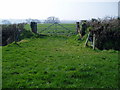
Gate to arable land south of Tytherleigh
Route of footpath to Axe Farm.
Image: © Peter Holmes
Taken: 18 Mar 2009
0.12 miles
2
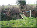
Overgrown Footbridge
Useful footbridge on route between Axe Farm and Tytherleigh.
Image: © Peter Holmes
Taken: 18 Mar 2009
0.17 miles
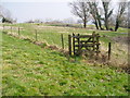
4
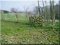
Footpath with kissing gate (1)
Path enters new plantation.
Image: © Peter Holmes
Taken: 18 Mar 2009
0.21 miles
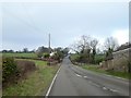
5

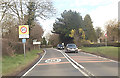
A358 at Fordwater
The building on the right is a tea shop
Image: © John Firth
Taken: 12 Apr 2013
0.22 miles
6
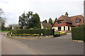
House in Tytherleigh
This very neat detached house in the village has a rather tatty little sign announcing its name as Gransden Cottage. It is on Broom Lane close to its junction with the A358 Axminster to Chard road.
Image: © Nigel Mykura
Taken: 12 Mar 2017
0.22 miles
7
Footpath with kissing gate (2)
Path leaves new plantation and continues towards Lower Tytherleigh Farm.
Image: © Peter Holmes
Taken: 18 Mar 2009
0.23 miles
8
A358 at Fordwater
The farm is on the northern side of the shallow valley of a stream flowing to the Axe. Much of this stretch of road follows the Roman Fosse Way, and it crosses this valley in a straight line
Image: © David Smith
Taken: 30 Dec 2019
0.24 miles
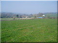
9
Route of footpath to Tytherleigh
Houses in Tytherleigh can be seen on the horizon.
Image: © Peter Holmes
Taken: 18 Mar 2009
0.24 miles
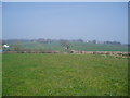
10
Fordwater
Fields near Fordwater and Whitehall which front on the A358.
Image: © Peter Holmes
Taken: 18 Mar 2009
0.24 miles