
IMAGES TAKEN NEAR TO
AXMINSTER, EX13 5RJ
Introduction
This page details the photographs taken nearby to EX13 5RJ by members of the Geograph project.
The Geograph project started in 2005 with the aim of publishing, organising and preserving representative images for every square kilometre of Great Britain, Ireland and the Isle of Man.

There are currently over 7.5m images from over14,400 individuals and you can help contribute to the project by visiting https://www.geograph.org.uk
Image Map
Images are licensed for reuse under creativecommons.org/licenses/by-sa/2.0
Notes
- Clicking on the map will re-center to the selected point.
- The higher the marker number, the further away the image location is from the centre of the postcode.
Image Listing (9 Images Found)
Images are licensed for reuse under creativecommons.org/licenses/by-sa/2.0
Image
Details
Distance
1
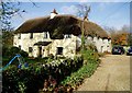
The Old House, Hunthay, EX13 5RJ
17th century or earlier, east wing with additional 18th century wing, Grade II listed thatched farmhouse. see also Image
Image: © Peter Holmes
Taken: 22 Nov 2009
0.11 miles
4
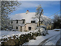
The Old House Hunthay
Original Farmhouse for Hunthay Farm still fully thatched. Was home of Clements Dane (Bloomsbury Set) and later Doctor David Molesworth (central to the cure of Leprosy)
Image: © William Bartlett
Taken: 25 Nov 2005
0.16 miles
8
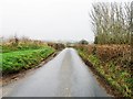
Track to Hunthay Farm
The track is heading into the Yarty valley from Hunthay Lane.
Image: © Derek Harper
Taken: 31 Jul 2015
0.23 miles
9
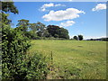
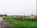
By Hunthay Lane
The line of trees surrounds the grounds of Hunthay Close, on a rise between the Yarty and the Axe valleys.
Image: © Derek Harper
Taken: 31 Jul 2015
0.23 miles