1
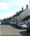
Coombefield Lane houses, Axminster
On the south side of Coombefield Lane opposite Coombe Lane Long Stay Car Park.
Image: © Jaggery
Taken: 9 Mar 2017
0.03 miles
2
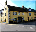
Coombe Street meets South Street
Taken from the car park.
Image: © RNE
Taken: 11 Dec 2005
0.03 miles
3
Frank Rowe House, Musbury Road
Modern house on site of the Market Hall. The market closed in 2006 following the outbreak of Foot and Mouth disease.
Image: © Roger Templeman
Taken: 20 Sep 2012
0.04 miles
4
Frank Rowe House, South Street, Axminster
A Cattle Market blue plaque http://www.geograph.org.uk/photo/5331695 is on the wall of Frank Rowe House.
Image: © Jaggery
Taken: 9 Mar 2017
0.04 miles
5
Cattle Market blue plaque, Axminster
The Historical Axminster blue plaque on the wall of Frank Rowe House http://www.geograph.org.uk/photo/5331691 records that a Charter was granted to the town in 1210, which included the right to hold a weekly market. The market was held in Market Square until 1834. It was then moved to Trinity Square. The Market then moved to this site on 6th October 1912 and after 94 years, sadly was closed in 2006 following the outbreak of Foot and Mouth disease.
Image: © Jaggery
Taken: 9 Mar 2017
0.04 miles
6
Coombefield Lane, Axminster
Looking to the SE from the corner of Coombe Lane in March 2017.
Coombe Lane Long Stay Car Park is on the left.
Image: © Jaggery
Taken: 9 Mar 2017
0.04 miles
7
Corner of Silver Street and Musbury Road, Axminster
Silver Street is on the right.
Image: © Jaggery
Taken: 9 Mar 2017
0.05 miles
8
Cinnamons in Axminster
South Street Indian cuisine restaurant on the corner of Coombe Lane.
Image: © Jaggery
Taken: 9 Mar 2017
0.05 miles
9
Coombe Lane Long Stay Car Park, Axminster
Coombe Lane is on the left. Coombefield Lane is on the right.
Image: © Jaggery
Taken: 9 Mar 2017
0.05 miles
10
Complete Meats in Axminster
Butchers on the corner of South Street and Church Street.
Image: © Jaggery
Taken: 9 Mar 2017
0.05 miles


