1
United Reformed Church information board, Axminster
On the right here. http://www.geograph.org.uk/photo/5321673
Image: © Jaggery
Taken: 9 Mar 2017
0.02 miles
2
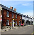
Reflections in Axminster
Reflections Hair & Beauty is located in the Old Bakehouse, Chard Street.
Image: © Jaggery
Taken: 9 Mar 2017
0.02 miles
3
Benchmark on the United Reformed Church, Chard Street
Ordnance Survey cut mark benchmark described on the Bench Mark Database at http://www.bench-marks.org.uk/bm45534
Image: © Roger Templeman
Taken: 20 Sep 2012
0.02 miles
4
United Reformed Church and church hall, Chard Street
The church was originally the Axminster Independent Church. The hall dates at 1698. There is an OS benchmark
Image on the left side of the church by the blue downpipe.
Image: © Roger Templeman
Taken: 20 Sep 2012
0.02 miles
5
Axminster : The United Reformed Church
A church on the A358.
Image: © Lewis Clarke
Taken: 9 Jul 2016
0.02 miles
6
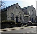
United Reformed church hall and church, Chard Street, Axminster
The Historical Axminster blue plaque http://www.geograph.org.uk/photo/5321678 on the church hall on the left records that the first chapel of the Axminster Independent Church (later the Congregational Church, now the United Reformed Church) was built in 1698. At one time with a thatched roof, long since replaced by slates, it stands beside a larger church on the right, built in 1828. The older building is now used as the church hall. Thomas Whitty, founder of the Axminster Carpet Industry, is commemorated by a plaque on the building and is buried in the little graveyard.
The United Reformed Church Axminster was Grade II listed in 1983.
Image: © Jaggery
Taken: 9 Mar 2017
0.02 miles
7
Axminster Health & Wellbeing Centre, Axminster
Viewed across Chard Street. Reflections Hair & Beauty http://www.geograph.org.uk/photo/5320614 is on the right.
Image: © Jaggery
Taken: 9 Mar 2017
0.02 miles
8
Former drill hall - Chard Street
18th Century Meeting Hall, now Cooper's Cottages. Apparently remained in use as a drill hall until 1935.
Image: © John M
Taken: 13 Sep 2014
0.02 miles
9
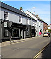
Up Chard Street, Axminster
The A358 Chard Street ascends away from the town centre.
Image: © Jaggery
Taken: 9 Mar 2017
0.02 miles
10
United Reformed Church and church hall, Chard Street, Axminster
The Historical Axminster blue plaque http://www.geograph.org.uk/photo/5321678 on the church hall on the left records that the first chapel of the Axminster Independent Church (later the Congregational Church, now the United Reformed Church) was built in 1698. At one time with a thatched roof, long since replaced by slates, it stands beside a larger church built in 1828 and is now used as the church hall. Thomas Whitty, founder of the Axminster Carpet Industry, is commemorated by a plaque on the building and is buried in the little graveyard.
The United Reformed Church Axminster was Grade II listed in 1983.
Image: © Jaggery
Taken: 9 Mar 2017
0.03 miles


