
IMAGES TAKEN NEAR TO
Heavitree Road, EXETER, EX1 2LG
Introduction
This page details the photographs taken nearby to Heavitree Road, EX1 2LG by members of the Geograph project.
The Geograph project started in 2005 with the aim of publishing, organising and preserving representative images for every square kilometre of Great Britain, Ireland and the Isle of Man.

There are currently over 7.5m images from over14,400 individuals and you can help contribute to the project by visiting https://www.geograph.org.uk
Image Map
Images are licensed for reuse under creativecommons.org/licenses/by-sa/2.0
Notes
- Clicking on the map will re-center to the selected point.
- The higher the marker number, the further away the image location is from the centre of the postcode.
Image Listing (444 Images Found)
Images are licensed for reuse under creativecommons.org/licenses/by-sa/2.0
Image
Details
Distance
1

Heavitree Road, Exeter
Image: © Derek Harper
Taken: 25 Nov 2008
0.02 miles
2
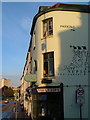
Just Neptune, Exeter
This fish and chip shop is on the corner of Russell Street and Heavitree Road, which continues (left) into the centre of Exeter.
Image: © Derek Harper
Taken: 24 Oct 2006
0.02 miles
3
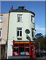
City Fast Food, Exeter
The Just Neptune fish bar, seen in Image, has become City Fast Food. On the right is Russell Street.
Image: © Derek Harper
Taken: 7 Oct 2011
0.02 miles
4
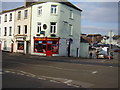
The outlet with two names
Russell Street, City Fast Food over the door, just Neptune on the side wall. Plus a little bit of graffiti lower down.
Image: © Anthony Vosper
Taken: 8 Feb 2012
0.02 miles
5
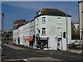
Transformed fish and chip shop, Heavitree Road, Exeter
The shop on the corner retains the painted sign, but the premises are now used by an accountancy business
Image: © David Smith
Taken: 5 Apr 2020
0.02 miles
6
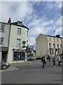
Fish and chip shop, Heavitree Road, Exeter
The clock is stopped.
Image: © David Smith
Taken: 24 Feb 2017
0.02 miles
7

New property wall, Denmark Road, Exeter
The highway authority conceded that the former wall was not the true property boundary and that the pavement had encroached on the property
Image: © David Smith
Taken: 4 Mar 2021
0.03 miles
8
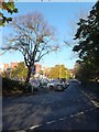
Clifton Road, Exeter
On the left is a large car park. Before Exeter was bombed in 1942, there were several streets of terraced houses here. One reminder of this is a right of way across the car park, marked by posts. On the right are the grounds of St Matthew's church hall Image
Image: © David Smith
Taken: 10 Nov 2013
0.03 miles
9
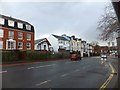
Heavitree Road, Exeter
The south side of the road, looking towards the city centre. On the left is a post-WW2 block of flats, then the meeting hall of Exeter Christadelphians, and then mainly older properties, two of which have been combined to form a small hotel.
Image: © David Smith
Taken: 3 Jan 2014
0.03 miles
10
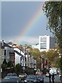
Heavitree Road, Exeter
Heavitree Road is one of the principal roads into Exeter from the east. It descends to the valley of the Shutebrook and joins Paris Street which leads to John Lewis (large white building) and the crock of gold under the rainbow
Image: © David Smith
Taken: 28 Oct 2013
0.04 miles