
IMAGES TAKEN NEAR TO
Jubilee Road, EXETER, EX1 2HX
Introduction
This page details the photographs taken nearby to Jubilee Road, EX1 2HX by members of the Geograph project.
The Geograph project started in 2005 with the aim of publishing, organising and preserving representative images for every square kilometre of Great Britain, Ireland and the Isle of Man.

There are currently over 7.5m images from over14,400 individuals and you can help contribute to the project by visiting https://www.geograph.org.uk
Image Map
Images are licensed for reuse under creativecommons.org/licenses/by-sa/2.0
Notes
- Clicking on the map will re-center to the selected point.
- The higher the marker number, the further away the image location is from the centre of the postcode.
Image Listing (128 Images Found)
Images are licensed for reuse under creativecommons.org/licenses/by-sa/2.0
Image
Details
Distance
1

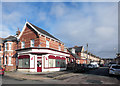
Jubilee Road, Exeter
A suburban street of terraced houses, dating from the 1890s and 1900s. On the wall is a ghost sign for POLSLOE ???? DAIRY (the area having been Polsloe Park)
Image: © David Smith
Taken: 15 Mar 2017
0.01 miles
2

Jubilee Road, Exeter
A residential street that dates from the end of the 19th century or early 20th. The wall painting by "The Old Dairy" is noteworthy.
Image: © David Smith
Taken: 31 Jan 2010
0.03 miles
4
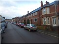
Manston Road, Exeter
The terraced houses were built at the end of the 19th century and start of the 20th century. However, space was left for a church hall, which was used as a place of worship. When the hall was demolished, the houses on the right were built to fill the gap. The foundation stone of the hall is at St Mark's church Image
Image: © David Smith
Taken: 5 Dec 2012
0.06 miles
5
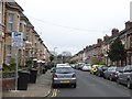
Park Road, Exeter
Terraced houses from the 1890s and 1900s on the site of Polsloe Park
Image: © David Smith
Taken: 15 Mar 2017
0.06 miles
6

Hairdresser's, St John's Road, Exeter
At the junction with Pinhoe Road, part of the terraced houses constructed at the end of the 19th century or early 20th, when Exeter's trams ran along the main road. The shop building has white facing bricks with several decorative features; the canopy on the side is permanent with some decoration
Image: © David Smith
Taken: 18 Apr 2014
0.07 miles
7
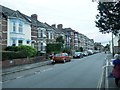
A change of style in a terrace, Polsloe Road, Exeter
The style of houses changes from two storey to three storey, part way along the terrace. None of these houses appear on the 1890 OS map, but all are present on the 1905 OS map, following the sale of the Polsloe House estate.
Image: © David Smith
Taken: 16 Aug 2020
0.07 miles

9
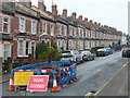
St. Anne's Road, Polsloe, Exeter
Judging by the parked cars it's not completely closed!
Early 20th century terraced housing a mile east of the city centre.
Image: © Jonathan Billinger
Taken: 11 Dec 2008
0.07 miles
10
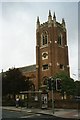
St Mark's Church, Exeter
Church built in the 1930's; it is built of brick, and the quality of the brickwork is very high.
Image: © David Smith
Taken: 10 Sep 2005
0.08 miles