
IMAGES TAKEN NEAR TO
Clifton Road, EXETER, EX1 2BR
Introduction
This page details the photographs taken nearby to Clifton Road, EX1 2BR by members of the Geograph project.
The Geograph project started in 2005 with the aim of publishing, organising and preserving representative images for every square kilometre of Great Britain, Ireland and the Isle of Man.

There are currently over 7.5m images from over14,400 individuals and you can help contribute to the project by visiting https://www.geograph.org.uk
Image Map
Images are licensed for reuse under creativecommons.org/licenses/by-sa/2.0
Notes
- Clicking on the map will re-center to the selected point.
- The higher the marker number, the further away the image location is from the centre of the postcode.
Image Listing (413 Images Found)
Images are licensed for reuse under creativecommons.org/licenses/by-sa/2.0
Image
Details
Distance

2

Golden Lion - Exeter
Newtown - an inner city residential area of Exeter.
Image: © Richard Knights
Taken: 30 Jun 2005
0.02 miles
3

Codrington Street, Exeter
In the Newtown area, developed in the mid-C19. The new housing on the right probably indicates bomb damage in 1942. Seen from the Triangle car park end of the street.
Image: © Derek Harper
Taken: 24 Oct 2006
0.02 miles
4
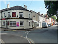
Clifton Road, Exeter
Terraces of Newtown, the city's first working-class settlement which was built up from c1830 (and "rehabilitated by the city council in 1967-70"). The obligatory corner pub, the Clifton Inn, nicely rounds the corner.
Image: © Stephen Richards
Taken: 19 Jun 2014
0.03 miles
6
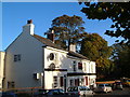
Clifton Inn, Exeter
Facing the Triangle car park at the corner of Clifton Road, this is a mid-C19 building.
Image: © Derek Harper
Taken: 24 Oct 2006
0.03 miles
7

War Memorial outside St Matthew's Church, Exeter
Image: © David Smith
Taken: 5 Feb 2009
0.04 miles
8
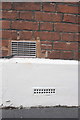
Benchmark on #23 Codrington Street
Ordnance Survey cut mark benchmark described on the Bench Mark Database at http://www.bench-marks.org.uk/bm39847
Image: © Roger Templeman
Taken: 23 Nov 2011
0.04 miles
9
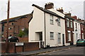
Houses on Codrington Street
There is an OS benchmark Image on #23 (second house from left) in the bricks just above the white concrete skirt
Image: © Roger Templeman
Taken: 23 Nov 2011
0.04 miles
