IMAGES TAKEN NEAR TO
Sea Hill, SEATON, EX12 2RH

Introduction

This page details the photographs taken nearby to Sea Hill, EX12 2RH by members of the Geograph project.

The Geograph project started in 2005 with the aim of publishing, organising and preserving representative images for every square kilometre of Great Britain, Ireland and the Isle of Man.

There are currently over 7.5m images from over14,400 individuals and you can help contribute to the project by visiting https://www.geograph.org.uk

Image Map


Images are licensed for reuse under creativecommons.org/licenses/by-sa/2.0
Notes
  • Clicking on the map will re-center to the selected point.
  • The higher the marker number, the further away the image location is from the centre of the postcode.

Image Listing (380 Images Found)

Images are licensed for reuse under creativecommons.org/licenses/by-sa/2.0
  • ...
Image
Details
Distance
1
Holmleigh House and Seaswift House
Early 20th Century terrace on Sea Hill, with the far section (Holmleigh House) now a Bed and Breakfast) and the nearer 3 sections (Seaswift House) a care home.
Image: © Ian Capper Taken: 8 Feb 2020
0.02 miles
2
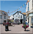
Seaton town centre
Seaton town centre on this glorious and fantastic Sunday late afternoon but this was after the shops closed
Image: © Ryan Griffiths Taken: 22 May 2022
0.03 miles
3
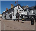
Seaton : "The Malt House"
Image: © Jim Osley Taken: 19 Jul 2018
0.03 miles
4
Seaton Clock Tower
Viewed from the east.
Image: © Peter Wood Taken: 2 Apr 2014
0.04 miles
5
Seaton : Jubilee Clock Tower and ornamental garden
The Jubilee Clock, standing at the top of Sea Hill, was built in 1887 to commemorate Queen Victoria’s Golden Jubilee
Image: © Jim Osley Taken: 19 Jul 2018
0.04 miles
6
Seafield Road
Terrace on Seafield Road, much of which is shown on the 1889 1:2,500 map, with the exception of the nearest section which first appears on the 1904 edition. On both maps it is marked as Seaview Crescent, the current name not appearing until the 1936 edition, prior to which it was applied to what is now Sea Hill.
Image: © Ian Capper Taken: 8 Feb 2020
0.04 miles
7
Ordnance Survey Flush Bracket G3245
This can be found on the wall of a private dwelling in Eyrecourt Road, Seaton. For more detail see : http://www.bench-marks.org.uk/bm429
Image: © Peter Wood Taken: 2 Apr 2014
0.04 miles
8
The Malt House - Queen Street
Image: © Betty Longbottom Taken: 14 May 2018
0.04 miles
9
The Famous George Inn, Seaton
Located in The Square, this is one of the oldest pubs in the town. The owners evidently didn't think its name was famous enough, however, as it was changed to the Malt House some years after this photograph was taken.
Image: © Stephen McKay Taken: Unknown
0.04 miles
10
Eyrecourt Road - Sea Hill
Image: © Betty Longbottom Taken: 14 May 2018
0.04 miles
  • ...