
IMAGES TAKEN NEAR TO
Holcombe Lane, OTTERY ST. MARY, EX11 1PQ
Introduction
This page details the photographs taken nearby to Holcombe Lane, EX11 1PQ by members of the Geograph project.
The Geograph project started in 2005 with the aim of publishing, organising and preserving representative images for every square kilometre of Great Britain, Ireland and the Isle of Man.

There are currently over 7.5m images from over14,400 individuals and you can help contribute to the project by visiting https://www.geograph.org.uk
Image Map
Images are licensed for reuse under creativecommons.org/licenses/by-sa/2.0
Notes
- Clicking on the map will re-center to the selected point.
- The higher the marker number, the further away the image location is from the centre of the postcode.
Image Listing (13 Images Found)
Images are licensed for reuse under creativecommons.org/licenses/by-sa/2.0
Image
Details
Distance
1
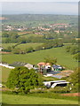
Raxhayes Farm from Westgate Hill
Or from the footpath that runs across the scarp and below its steepest part. Beyond the farm is Ottery St Mary, beyond that West Hill, and in the very distance the white dot is Haldon Belvedere Image .
Image: © Derek Harper
Taken: 23 May 2006
0.03 miles
2
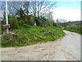
Orange Way in Devon and Torbay (392)
Holcombe Lane passes Raxhayes Farm entrance.
Image: © Shazz
Taken: 16 Apr 2012
0.05 miles
4
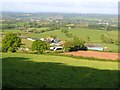
Raxhayes Farm from Westgate Hill
Showing Image in a wider context, again with Ottery St Mary the town in the middle distance, and with Otter Nurseries away on the right.
Image: © Derek Harper
Taken: 23 May 2006
0.09 miles
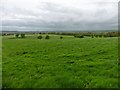
6
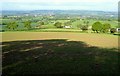
Farmland near Raxhayes Farm
From the same spot as Image], looking down the scarp slope, with Ottery St Mary in the distance.
Image: © Derek Harper
Taken: 23 May 2006
0.11 miles
7
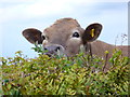
Orange Way in Devon and Torbay (391)
"Who you looking at?" might be the message.
Image: © Shazz
Taken: 16 Apr 2012
0.12 miles
8
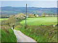
Orange Way in Devon and Torbay (393)
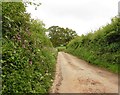
This is looking back down Holcombe Lane from Raxhayes Farm entrance.
Image: © Shazz
Taken: 16 Apr 2012
0.13 miles
9
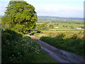
Holcombe Lane at Moor Croft Farm
The tarmaced lane ends at the farm, where it meets the steepest part of the Westgate Hill scarp. This looks back down it, with Razhayes Farm on the right. 8:34 am.
Image: © Derek Harper
Taken: 23 May 2006
0.16 miles
10
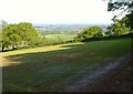
Field below Westgate Hill
From Ottery St Mary Footpath 17 looking along and down the scarp slope, with a trio of oak trees partly obscuring Raxhayes Farm.
Image: © Derek Harper
Taken: 23 May 2006
0.21 miles