
IMAGES TAKEN NEAR TO
Woolbrook Rise, SIDMOUTH, EX10 9UB
Introduction
This page details the photographs taken nearby to Woolbrook Rise, EX10 9UB by members of the Geograph project.
The Geograph project started in 2005 with the aim of publishing, organising and preserving representative images for every square kilometre of Great Britain, Ireland and the Isle of Man.

There are currently over 7.5m images from over14,400 individuals and you can help contribute to the project by visiting https://www.geograph.org.uk
Image Map
Images are licensed for reuse under creativecommons.org/licenses/by-sa/2.0
Notes
- Clicking on the map will re-center to the selected point.
- The higher the marker number, the further away the image location is from the centre of the postcode.
Image Listing (68 Images Found)
Images are licensed for reuse under creativecommons.org/licenses/by-sa/2.0
Image
Details
Distance
1
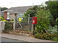
Woolbrook Rise Post box and ?
There is a danger of death warning on the site here. The electricity transformer however was never installed.
Image: © Anthony Vosper
Taken: 8 Sep 2009
0.05 miles
2
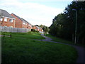
Behind the houses
A modern footpath follows an older field boundary off Stowford Rise.
Image: © Anthony Vosper
Taken: 1 Oct 2009
0.06 miles
3

Zig-zag path to Woolbrook Rise
The path, whose hairpin bends give a slightly exaggerated impression of the steepness of the terrain, allows access to the closes off Stowford Rise, and hence Waitrose, from the older housing on Ashley Crescent and Woolbrook Rise.
Image: © Derek Harper
Taken: 11 Jan 2012
0.08 miles
4
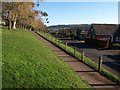
Path from Woolbrook Rise
Image: © Derek Harper
Taken: 11 Jan 2012
0.09 miles
5
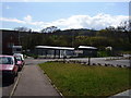
Sidmouth Cadet Centre, Stowford
Serving the Air and Army Cadets.
This has been built on the ' vacant plot ' that was photographed on this square.
Image: © Anthony Vosper
Taken: 27 Apr 2012
0.09 miles
6
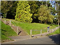
Choices, Woolbrook Rise
Both the steps and the zig-zag path end at the same spot at the top of the bank.
Image: © Anthony Vosper
Taken: 16 Sep 2009
0.09 miles
7

Footpath Core Hill Road
Local footpath No15. Quite a bit of this area can still be traversed by using the original footpaths through the area.
Image: © Anthony Vosper
Taken: 3 Sep 2009
0.10 miles
8
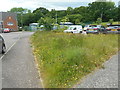
A paradise for bees
A small area of uncut grasses and wildflowers close to the Stowford Community Centre. A deliberate act or a mistake. Either way there are a good variety of flowers and plenty of bees.
Image: © Anthony Vosper
Taken: 30 May 2019
0.10 miles
9
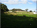
Vacant lot
An area of green awaits the building of a new community centre off Stowford Rise.
Core Hill features in the background.
Image: © Anthony Vosper
Taken: 1 Oct 2009
0.10 miles
10
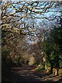
Core Hill Road, Sidmouth
The road shown from the opposite direction in Image, here climbing away from housing between and beneath trees.
Image: © Derek Harper
Taken: 11 Jan 2012
0.10 miles