IMAGES TAKEN NEAR TO
Burscombe Lane, SIDMOUTH, EX10 9SF
Introduction
This page details the photographs taken nearby to Burscombe Lane, EX10 9SF by members of the Geograph project.
The Geograph project started in 2005 with the aim of publishing, organising and preserving representative images for every square kilometre of Great Britain, Ireland and the Isle of Man.

There are currently over 7.5m images from over14,400 individuals and you can help contribute to the project by visiting https://www.geograph.org.uk
Image Map
Images are licensed for reuse under creativecommons.org/licenses/by-sa/2.0
Notes
- Clicking on the map will re-center to the selected point.
- The higher the marker number, the further away the image location is from the centre of the postcode.
Image Listing (19 Images Found)
Images are licensed for reuse under creativecommons.org/licenses/by-sa/2.0
Image
Details
Distance
1

OS benchmark - Sidford, Burscombe Lane
An OS cutmark on a stone wall at the junction of Burscombe Lane with Back Lane. It was originally levelled, probably in 1967, at 87.609m above Ordnance Datum Newlyn.
Image: © Richard Law
Taken: 15 Jul 2017
0.02 miles

3

Burscombe Lane junction
A good example of urban regeneration. The new apartments in the background replaced a pre war house.
Image: © Anthony Vosper
Taken: 15 Sep 2009
0.05 miles
4

Burscombe Lane Junction. Island.
Choose any number of permutations, Bus stop, Post box, sign or bench.All contained on an island in the middle of the road junction.
Soldiers hill is in the background.
Image: © Anthony Vosper
Taken: 15 Sep 2009
0.05 miles
5

Heritage Way, Sidmouth
Housing developments on the north side of Sidmouth.
Image: © Richard Law
Taken: 15 Jul 2017
0.08 miles
6

King Charles' Way, Sidmouth
Housing on the north side of Sidmouth.
Image: © Richard Law
Taken: 15 Jul 2017
0.09 miles
7

Manstone lane
A sharp turn to a one way system off the busy A3052.
Image: © Anthony Vosper
Taken: 4 Jan 2022
0.11 miles
8

Burscombe lane, foot path
Local F.P No50 somewhat overgrown. In winter it runs with water making it almost impassable.
Image: © Anthony Vosper
Taken: 15 Sep 2009
0.12 miles
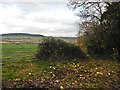
9

Footpath from Burscombe Lane to Sidbury
The path is well protected on the south side from the wind from the sea up the valley of the River Sid
Image: © David Smith
Taken: 4 Apr 2012
0.12 miles