
IMAGES TAKEN NEAR TO
Arcot Park, SIDMOUTH, EX10 9HU
Introduction
This page details the photographs taken nearby to Arcot Park, EX10 9HU by members of the Geograph project.
The Geograph project started in 2005 with the aim of publishing, organising and preserving representative images for every square kilometre of Great Britain, Ireland and the Isle of Man.

There are currently over 7.5m images from over14,400 individuals and you can help contribute to the project by visiting https://www.geograph.org.uk
Image Map
Images are licensed for reuse under creativecommons.org/licenses/by-sa/2.0
Notes
- Clicking on the map will re-center to the selected point.
- The higher the marker number, the further away the image location is from the centre of the postcode.
Image Listing (117 Images Found)
Images are licensed for reuse under creativecommons.org/licenses/by-sa/2.0
Image
Details
Distance
1
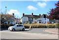
Houses on Arcot Rd
Arcot Rd is the road coming in at an angle where it joins the Sidmouth Rd the A375.
Image: © Nigel Mykura
Taken: 23 Sep 2022
0.03 miles
3
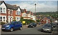
Winslade Road, Sidmouth
Gabled properties towards the foot of the hill, with the junction with the A375 at the bottom.
Image: © Derek Harper
Taken: 9 Sep 2016
0.08 miles
4
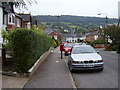
Swapped around, the camera does lie again
This small Elizabethan Post box situated in Winslade Road was swapped round with the one from the top of Alexandria Road. Salcombe Hill features in the background.
Image: © Anthony Vosper
Taken: 9 Oct 2009
0.08 miles
6

Winslade Road
From left to right.
Turnpike cottages, Potburys Storage Merivail House.
Image: © Anthony Vosper
Taken: 11 Feb 2015
0.10 miles
7
Potburys Storage
Wislade Road Sidmouth.
Image: © Anthony Vosper
Taken: 11 Feb 2015
0.10 miles
8

Malvern Road
Whilst described as a road it actually terminates at the top of the hill.
It was built on land belonging to Arcot House, which is close by.
Image: © Anthony Vosper
Taken: 2 Mar 2023
0.10 miles
9

The Wool Brook goes under Sidford Road
The dam like structure is left over from WWII, so as to raise the height of the river to draw water in case of fire as a result of an air raid.
Raids and bombs where few and far between.
Image: © Anthony Vosper
Taken: 25 Sep 2009
0.11 miles
10

Livonia Bridge, Sidford Road, Lower Woolbrook
Pedestrians have a new, narrow, bridge, away from the traffic
Image: © David Smith
Taken: 24 Aug 2018
0.11 miles