
IMAGES TAKEN NEAR TO
Brownlands Close, SIDMOUTH, EX10 9AS
Introduction
This page details the photographs taken nearby to Brownlands Close, EX10 9AS by members of the Geograph project.
The Geograph project started in 2005 with the aim of publishing, organising and preserving representative images for every square kilometre of Great Britain, Ireland and the Isle of Man.

There are currently over 7.5m images from over14,400 individuals and you can help contribute to the project by visiting https://www.geograph.org.uk
Image Map
Images are licensed for reuse under creativecommons.org/licenses/by-sa/2.0
Notes
- Clicking on the map will re-center to the selected point.
- The higher the marker number, the further away the image location is from the centre of the postcode.
Image Listing (38 Images Found)
Images are licensed for reuse under creativecommons.org/licenses/by-sa/2.0
Image
Details
Distance
1
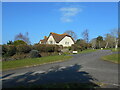
Gilchrist Way
Situated on the Brownlands estate built in the 1970's.
Image: © Anthony Vosper
Taken: 2 Mar 2023
0.04 miles
2
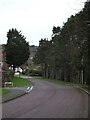
Looking up Brownlands Road in Sid
A small residential road on the side of the hill. From the aerial view, the trees on the right can be seen to be one side of a pathway with trees on each side.
Image: © David Smith
Taken: 22 Dec 2011
0.08 miles
3
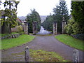
Closed off
This ornate gateway and tree lined driveway now only allows pedestrian access.
Situated off Sid Road it originally was the entrance to Brownlands house.
With the building of a new estate in the 1970's the road fell into disuse.
Image: © Anthony Vosper
Taken: 15 Jan 2010
0.11 miles
4
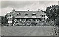
Brownlands, Sidmouth in the 40s
The home of inventor and engineer Sidney Brown and his wife Alice. I'm unsure if this was taken while Mr Brown was still alive; he died in August 1948.
The house was built by astronomer Norman Lockyer in 1909. The Norman Lockyer Observatory was established in 1912 on the hill above the house.
The house survives as a hotel.
Image: © George Harper
Taken: Unknown
0.14 miles
5

The Redwood Pine
Over 100 years old situated in Redwood Road.
Image: © Anthony Vosper
Taken: 15 Jan 2010
0.14 miles
7

OS benchmark - Sidmouth, Salcombe Hill
An OS cutmark on Craig Court; originally levelled, probably in 1962, at 44.693m above Ordnance Datum Newlyn.
Image: © Richard Law
Taken: 16 Jul 2017
0.15 miles

10
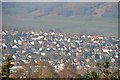
Sidmouth : Town Scenery
Looking across the town of Sidmouth towards houses.
Image: © Lewis Clarke
Taken: 9 Mar 2014
0.17 miles