
IMAGES TAKEN NEAR TO
Cranford, SIDMOUTH, EX10 8UT
Introduction
This page details the photographs taken nearby to Cranford, EX10 8UT by members of the Geograph project.
The Geograph project started in 2005 with the aim of publishing, organising and preserving representative images for every square kilometre of Great Britain, Ireland and the Isle of Man.

There are currently over 7.5m images from over14,400 individuals and you can help contribute to the project by visiting https://www.geograph.org.uk
Image Map
Images are licensed for reuse under creativecommons.org/licenses/by-sa/2.0
Notes
- Clicking on the map will re-center to the selected point.
- The higher the marker number, the further away the image location is from the centre of the postcode.
Image Listing (180 Images Found)
Images are licensed for reuse under creativecommons.org/licenses/by-sa/2.0
Image
Details
Distance
1
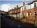
Sidholme Cottages,Brewery Lane
Note the distinct divide in the row of late Victorian houses.
An indication that the row was either built in two stages or by two different builders.
Image: © Anthony Vosper
Taken: 12 Jan 2016
0.03 miles
2
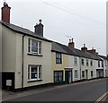
Temple Street houses, Sidmouth
The houses are on the east side of Temple Street. Showing its number on a wall and on a window, number 26 Temple Street is on the left.
Image: © Jaggery
Taken: 18 Jun 2013
0.05 miles
3
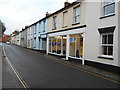
Cirrus Vape Shop, Temple Street
Whilst tobacco is perhaps no longer acceptable there has been a rise in shops selling e-cigarettes.
Image: © Anthony Vosper
Taken: 4 Jan 2018
0.05 miles
4

Apollonia House Dental Practice, Sidmouth
On the corner of Vicarage Road and Elysian Fields.
Image: © Jaggery
Taken: 18 Jun 2013
0.06 miles

6

Vicarage Road guesthouses, Sidmouth
There are several guesthouses in this part of Vicarage Road, about 850 metres from the sea front.
The guesthouse nearest the camera, in the middle of the view with a claret nameboard, is Avalon.
The street on the left is Lawn Vista.
Image: © Jaggery
Taken: 18 Jun 2013
0.07 miles
7
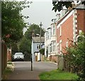
Lawn Vista, Sidmouth
The southern arm of the road; the terrace shown in Image is to the right.
Image: © Derek Harper
Taken: 9 Sep 2016
0.08 miles
8
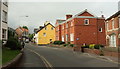
Police station, Sidmouth
Also shown in Image] and Image, and succeeded by the junction with Woolcombe Lane. It dates from 1911. The ochre-coloured house on the corner is described at https://www.historicengland.org.uk/listing/the-list/list-entry/1228254 ; see also Image The main road is Temple Street, the A375.
Image: © Derek Harper
Taken: 9 Sep 2016
0.08 miles
9

Police station, Sidmouth
Also seen in Image The brick building, designed by E H Herbottle & Son, dates from 1911.
Image: © Derek Harper
Taken: 9 Sep 2016
0.08 miles
10

Apollonia House Dental surgery
Elysian Fields, Vicarage Road.Saint Apollonia is the patron saint of dentists.
Image: © Anthony Vosper
Taken: 23 Oct 2009
0.08 miles