
IMAGES TAKEN NEAR TO
Mill Street, SIDMOUTH, EX10 8DW
Introduction
This page details the photographs taken nearby to Mill Street, EX10 8DW by members of the Geograph project.
The Geograph project started in 2005 with the aim of publishing, organising and preserving representative images for every square kilometre of Great Britain, Ireland and the Isle of Man.

There are currently over 7.5m images from over14,400 individuals and you can help contribute to the project by visiting https://www.geograph.org.uk
Image Map
Images are licensed for reuse under creativecommons.org/licenses/by-sa/2.0
Notes
- Clicking on the map will re-center to the selected point.
- The higher the marker number, the further away the image location is from the centre of the postcode.
Image Listing (745 Images Found)
Images are licensed for reuse under creativecommons.org/licenses/by-sa/2.0
Image
Details
Distance
1
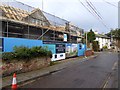
Building site, Sidmouth
Building retirement housing on a brownfield site in Sidmouth
Image: © David Smith
Taken: 10 Jan 2015
0.00 miles
2
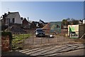
Sidmouth : Mill Gardens
Construction of retirement homes in Sidmouth on Mill Street.
Image: © Lewis Clarke
Taken: 9 Mar 2014
0.00 miles
3

School's out forever!
The former towns school now converted into flats.
Note the separate entrances for boys and girls.
Image: © Anthony Vosper
Taken: 23 Sep 2009
0.01 miles
4
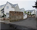
Millers Close, Sidmouth
Cul-de-sac on the west side of Mill Street.
Image: © Jaggery
Taken: 20 May 2018
0.01 miles
5
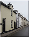
Row of houses on the east side of Mill Street, Sidmouth
On the west bank of the River Sid. Camomile Cottage is nearest the camera.
Image: © Jaggery
Taken: 20 May 2018
0.01 miles
6
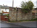
The former Sidmouth Lock up
All that remains is a wall and a few rusting bars on the windows.Note the Buddleia bush, nice but you wouldn't want one on your garden wall.
Image: © Anthony Vosper
Taken: 23 Sep 2009
0.02 miles
7
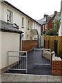
A disputed footpath
Partway along the path is a sign, which reads: "No public right of way. This path was built by (building company for the development on the right) against the wishes of local residents and planners. Please support us by not using this path"
Image: © David Smith
Taken: 14 Sep 2015
0.02 miles
8
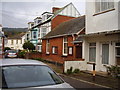
Oh so small
Holmdale chapel. a small red bricked building sandwiched between houses and a former shop.
Image: © Anthony Vosper
Taken: 23 Sep 2009
0.02 miles
9
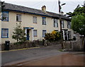
Old Mill House and Bridge House, Mill Street, Sidmouth
Located near the southern edge of this https://www.geograph.org.uk/photo/5794277 River Sid ford.
Dating from c1830, Old Mill House (on the left) and Bridge House were jointly Grade II listed in 1973.
Image: © Jaggery
Taken: 20 May 2018
0.02 miles
10
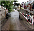
Into the River Sid ford, Mill Street, Sidmouth
The southern end of this https://www.geograph.org.uk/photo/5794277 ford.
Image: © Jaggery
Taken: 20 May 2018
0.02 miles