
IMAGES TAKEN NEAR TO
Sidbury, SIDMOUTH, EX10 0QP
Introduction
This page details the photographs taken nearby to EX10 0QP by members of the Geograph project.
The Geograph project started in 2005 with the aim of publishing, organising and preserving representative images for every square kilometre of Great Britain, Ireland and the Isle of Man.

There are currently over 7.5m images from over14,400 individuals and you can help contribute to the project by visiting https://www.geograph.org.uk
Image Map
Images are licensed for reuse under creativecommons.org/licenses/by-sa/2.0
Notes
- Clicking on the map will re-center to the selected point.
- The higher the marker number, the further away the image location is from the centre of the postcode.
Image Listing (10 Images Found)
Images are licensed for reuse under creativecommons.org/licenses/by-sa/2.0
Image
Details
Distance
2
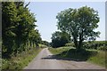
Road near Moorlands Farm, Sidbury
View looking down the hill near Moorlands Farm, Sidbury, Devon.
Image: © Kevin Hale
Taken: 16 Jul 2006
0.11 miles
3
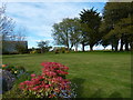
A Cessna at the bottom of the garden
Light aircraft parked outside the hangar at Farway Common airfield.
Image: © James Allan
Taken: 30 Apr 2015
0.12 miles
4
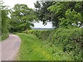
Road at Barnes Sturges
The road is running along a flattish ridge, with the Roncombe Stream valley on the right.
Image: © Derek Harper
Taken: 20 May 2011
0.13 miles
5
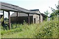
Farm building, Moorlands Farm, Sidbury
Farm building, Moorlands Farm, Sidbury, east Devon.
Image: © Kevin Hale
Taken: 16 Jul 2006
0.14 miles
6

Farway Common Airfield
Seen from under the wing of a Cessna 172 aircraft.
Image: © James Allan
Taken: 30 Apr 2015
0.20 miles
7

Cut hay, Moorlands Farm, Sidbury
Field of newly cut hay, Moorlands Farm, Sidbury, east Devon.
Image: © Kevin Hale
Taken: 16 Jul 2006
0.21 miles
8
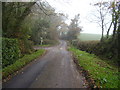
Footpaths crossing the road near Barnes Surges
Image: © Anthony Vosper
Taken: 14 Nov 2011
0.21 miles
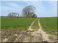
10
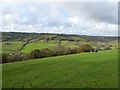
East Devon Way and Roncombe valley
The long distance path runs across this field, into the valley and then climbs past Lower Knapp Farm, seen in the distance just above the walkers
Image: © David Smith
Taken: 14 Nov 2014
0.23 miles