
IMAGES TAKEN NEAR TO
Sidbury, SIDMOUTH, EX10 0QJ
Introduction
This page details the photographs taken nearby to EX10 0QJ by members of the Geograph project.
The Geograph project started in 2005 with the aim of publishing, organising and preserving representative images for every square kilometre of Great Britain, Ireland and the Isle of Man.

There are currently over 7.5m images from over14,400 individuals and you can help contribute to the project by visiting https://www.geograph.org.uk
Image Map
Images are licensed for reuse under creativecommons.org/licenses/by-sa/2.0
Notes
- Clicking on the map will re-center to the selected point.
- The higher the marker number, the further away the image location is from the centre of the postcode.
Image Listing (12 Images Found)
Images are licensed for reuse under creativecommons.org/licenses/by-sa/2.0
Image
Details
Distance
1
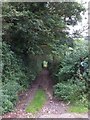
Bridleway leading across River Sid
This is one of several paths and bridleways that lead across the river and into the woodland on East Hill Strips
Image: © David Smith
Taken: 21 Aug 2012
0.05 miles
2
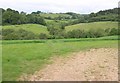
The Sid Valley
Looking across the valley from the lane down the east side. The belt of trees climbing from the riverside woodland crosses into Image
Image: © Derek Harper
Taken: 20 May 2011
0.07 miles
4
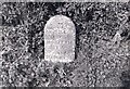
Old Milestone by the A375, below Pen Hill, north of Cotford
Sidmouth tombstone by the A375, in parish of Sidmouth (East Devon District), North of Synderborough Farm, by the West side of road.
Lost since 1970.
Inscription reads:-
V
MILE
From
HONITON
IV
to
SIDMOUTH
Carved benchmark on right face.
Milestone Society National ID: DV_HNSM05
Image: © Milestone Society
Taken: Unknown
0.13 miles
5
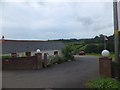
Sid Valley Country House Hotel
The hotel stretches along a minor road north of Sidbury; this is the car park entrance.
Image: © David Smith
Taken: 21 Aug 2012
0.14 miles
6
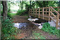
Ford and New Footbridge at Synderborough Farm
This ford is found on the byway leading to the hydraulic ram on Synderborough Farm. The ford was originally constructed to provide access to the pumping station at this point. There is a second ford further along the footpath.
Image: © John Walton
Taken: 25 Sep 2013
0.14 miles
7
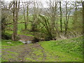
A small footbridge and ford on the River Sid
Image: © Anthony Vosper
Taken: 5 Apr 2012
0.14 miles
8
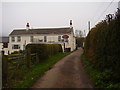
The Sid Valley Hotel
On a damp Autumn morning.
Image: © Anthony Vosper
Taken: 14 Nov 2011
0.16 miles
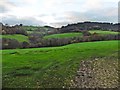
10
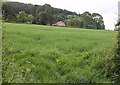
Field below the A375
A field of grass between the lane past the Sid Valley Country House Hotel and the A375; the house is beyond the main road on the slopes of Pen Hill.
Image: © Derek Harper
Taken: 20 May 2011
0.17 miles