
IMAGES TAKEN NEAR TO
Bowd, SIDMOUTH, EX10 0NF
Introduction
This page details the photographs taken nearby to EX10 0NF by members of the Geograph project.
The Geograph project started in 2005 with the aim of publishing, organising and preserving representative images for every square kilometre of Great Britain, Ireland and the Isle of Man.

There are currently over 7.5m images from over14,400 individuals and you can help contribute to the project by visiting https://www.geograph.org.uk
Image Map
Images are licensed for reuse under creativecommons.org/licenses/by-sa/2.0
Notes
- Clicking on the map will re-center to the selected point.
- The higher the marker number, the further away the image location is from the centre of the postcode.
Image Listing (35 Images Found)
Images are licensed for reuse under creativecommons.org/licenses/by-sa/2.0
Image
Details
Distance
1
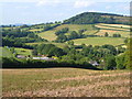
Bowd
A view over part of the settlement from beside Greenway Lane. Beacon Hill, beyond, is in the square to the north.
Image: © Derek Harper
Taken: 15 Jun 2006
0.04 miles
2
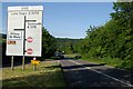
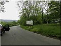
Sign at The Bowd, Sidmouth
Sign at The Bowd, Sidmouth
Image: © Kevin Hale
Taken: 13 Jun 2006
0.04 miles
3
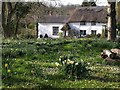
Cottages, Bowd
Attractive cottages seen from the A3052 by the junction at Bowd.
Image: © Derek Harper
Taken: 1 Apr 2008
0.05 miles
4
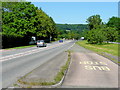
Bus stop at the A3052/B3176 junction
Looking east towards Sidford.
Image: © Jonathan Billinger
Taken: 2 Jun 2009
0.08 miles
5
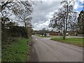
Junction where B3176 joins the A3052, looking west
Image: © Rob Purvis
Taken: 26 Feb 2023
0.09 miles
7
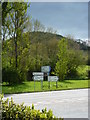
Road Signs in front of Bulverton Hill
As can be seen from outside of the Bowd Inn.
Image: © Steve Barnes
Taken: 3 May 2010
0.09 miles
8
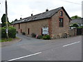
Barn at Bowd Court
Part of the group of buildings at Bowd Court, some of which hold Grade II listings. The B&B accommodation is at another (listed) farmhouse just along the lane.
Image: © Richard Law
Taken: 15 Jul 2017
0.10 miles
9
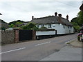
Bowd Court farmhouse
Grade II listed https://www.britishlistedbuildings.co.uk/101333817-bowd-farmhouse-sidmouth#.WX7bK4QrKM9 in 1973, the large thatched farmhouse dates from the 17th or 18th Century, and forms part of a group with the pub on the other side of the road, plus a barn and wall in the farmyard.
Image: © Richard Law
Taken: 15 Jul 2017
0.10 miles
10
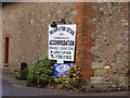
O S flush bracket at the Bowd
Bracket No:2086 situated low down to the right of the sign.
Image: © Anthony Vosper
Taken: 24 Jan 2011
0.10 miles