
IMAGES TAKEN NEAR TO
King Alfred Way, SIDMOUTH, EX10 0DG
Introduction
This page details the photographs taken nearby to King Alfred Way, EX10 0DG by members of the Geograph project.
The Geograph project started in 2005 with the aim of publishing, organising and preserving representative images for every square kilometre of Great Britain, Ireland and the Isle of Man.

There are currently over 7.5m images from over14,400 individuals and you can help contribute to the project by visiting https://www.geograph.org.uk
Image Map
Images are licensed for reuse under creativecommons.org/licenses/by-sa/2.0
Notes
- Clicking on the map will re-center to the selected point.
- The higher the marker number, the further away the image location is from the centre of the postcode.
Image Listing (31 Images Found)
Images are licensed for reuse under creativecommons.org/licenses/by-sa/2.0
Image
Details
Distance
1
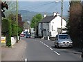
High Street, Newton Poppleford
After a cream tea Image, back on the horrid A3052 and the next killer hill. (Got to kill the clotted cream somehow.)
Image: © Richard Webb
Taken: 19 Apr 2011
0.06 miles
2
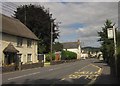
High Street, Newton Poppleford
The A3052 running through the village. On the left is Marigold Cottage, listed together with its neighbour http://list.english-heritage.org.uk/resultsingle.aspx?uid=1203642&searchtype=mapsearch - see Image
Image: © Derek Harper
Taken: 19 Aug 2013
0.08 miles
3
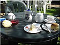
Cream Tea
A fond memory of climbing trips to South West England. A cream tea in a garden at the Southern Cross guest house, Newton Poppleford.
Image: © Richard Webb
Taken: 19 Apr 2011
0.09 miles
4

Southern Cross bed and breakfast, Newton Poppleford
Located at the eastern entrance to the village, on High Street.
Image: © Roger Cornfoot
Taken: 22 Dec 2008
0.09 miles
5
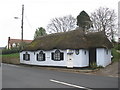
Ye Olde Tolle House, Newton Poppleford
Dated 1758.
Image: © Roger Cornfoot
Taken: 22 Dec 2008
0.10 miles
6

Bed and breakfast at Newton Poppleford
The "Southern Cross" advertises B&B and tea rooms; the porch opens onto the A3052. The road would have been much quieter when it was built!
Image: © David Smith
Taken: 25 Nov 2010
0.10 miles
7
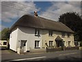
Thatched cottages, Newton Poppleford
Rose and Marigold Cottages are "probably late C18" http://list.english-heritage.org.uk/resultsingle.aspx?uid=1203642&searchtype=mapsearch . See also Image
Image: © Derek Harper
Taken: 19 Aug 2013
0.11 miles
8
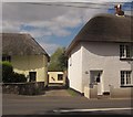
Thatched cottages, Newton Poppleford
On the left is part of The Gardens, a C17 thatched building http://list.english-heritage.org.uk/resultsingle.aspx?uid=1141411&searchtype=mapsearch ; on the right is Rose Cottage http://list.english-heritage.org.uk/resultsingle.aspx?uid=1203642&searchtype=mapsearch - see Image] .
Image: © Derek Harper
Taken: 19 Aug 2013
0.12 miles
9
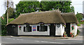
Old Toll House by High Street, Newton Poppleford
Toll House in the parish of Newton Poppleford and Harpford (East Devon District), Ye Olde Tolle House, High Street, EX10.
Grade II listed.
List Entry Number: 1281576 https://historicengland.org.uk/listing/the-list/list-entry/1281576
Surveyed
Milestone Society National ID: DV.NEP
Image: © Alan Rosevear
Taken: Unknown
0.12 miles
10
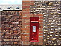
Bench Mark and Post Box
Bench mark and Victorian Post Box Situated on wall at junction of A3178 and B3178.
Image: © Anthony Vosper
Taken: 30 Jul 2009
0.12 miles