IMAGES TAKEN NEAR TO
Paternoster Hill, WALTHAM ABBEY, EN9 3JT
Introduction
This page details the photographs taken nearby to Paternoster Hill, EN9 3JT by members of the Geograph project.
The Geograph project started in 2005 with the aim of publishing, organising and preserving representative images for every square kilometre of Great Britain, Ireland and the Isle of Man.

There are currently over 7.5m images from over14,400 individuals and you can help contribute to the project by visiting https://www.geograph.org.uk
Image Map
Images are licensed for reuse under creativecommons.org/licenses/by-sa/2.0
Notes
- Clicking on the map will re-center to the selected point.
- The higher the marker number, the further away the image location is from the centre of the postcode.
Image Listing (16 Images Found)
Images are licensed for reuse under creativecommons.org/licenses/by-sa/2.0
Image
Details
Distance
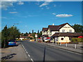
1
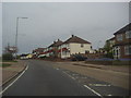
Paternoster Hill, Waltham Abbey
The Queen's Head pub is the last building along.
Image: © David Howard
Taken: 2 May 2012
0.01 miles
2
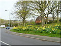
Daffodils by Ninefields
Ninefields is the spine road for a residential area of Waltham Abbey.
Image: © Robin Webster
Taken: 20 Mar 2014
0.04 miles
3
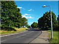
Ninefields, Waltham Abbey
Ninefields is a road throguh a 1970s housing estate in Waltham Abbey.
Image: © Malc McDonald
Taken: 7 Jun 2015
0.05 miles
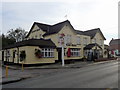
5
The Queen's Head, Upshire
The Queen's Head pub on Paternoster Hill in Upshire.
Image: © Malc McDonald
Taken: 7 Jun 2015
0.07 miles
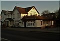
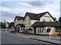
7

The Queens Head Public House
A McMullens house in Paternoster Hill
Image: © Phil Gaskin
Taken: 17 May 2011
0.08 miles
8
Queen's Head Public House, Paternoster Hill, Waltham Abbey, Essex
Image: © Christine Matthews
Taken: 7 Oct 2012
0.08 miles
9
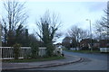
Galley Hill Road at the junction of Parklands
Image: © David Howard
Taken: 29 Dec 2018
0.13 miles
10
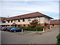
Paternoster House Care Home, Waltham Abbey, Essex
Image: © Christine Matthews
Taken: 7 Oct 2012
0.16 miles