
IMAGES TAKEN NEAR TO
Perry Hill, WALTHAM ABBEY, EN9 2LL
Introduction
This page details the photographs taken nearby to Perry Hill, EN9 2LL by members of the Geograph project.
The Geograph project started in 2005 with the aim of publishing, organising and preserving representative images for every square kilometre of Great Britain, Ireland and the Isle of Man.

There are currently over 7.5m images from over14,400 individuals and you can help contribute to the project by visiting https://www.geograph.org.uk
Image Map
Images are licensed for reuse under creativecommons.org/licenses/by-sa/2.0
Notes
- Clicking on the map will re-center to the selected point.
- The higher the marker number, the further away the image location is from the centre of the postcode.
Image Listing (9 Images Found)
Images are licensed for reuse under creativecommons.org/licenses/by-sa/2.0
Image
Details
Distance
1
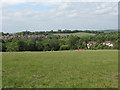
View from Perry Hill
A view northwards across grassland towards Lower Nazeing.
Image: © Stephen Craven
Taken: 23 May 2011
0.07 miles
2
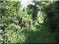
Cemetery Lane
A somewhat overgrown public bridleway running south from Lower Nazeing towards Waltham Abbey. I could not see any evidence of a cemetery along it, though.
Image: © Stephen Craven
Taken: 23 May 2011
0.07 miles
3

Perry Hill
Perry Hill is the name of this green lane (with the status of bridleway). Perry Hill Farm on the right.
Image: © Stephen Craven
Taken: 23 May 2011
0.08 miles
4
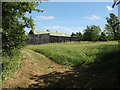
Perry Hill Farm
Viewed from the public bridleway.
Image: © Stephen Craven
Taken: 23 May 2011
0.09 miles
5
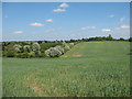
Green and pleasant land
A view from Cemetery Lane, eastwards across undulating farmland with several types of trees in the hedgerows.
Image: © Stephen Craven
Taken: 23 May 2011
0.13 miles
6
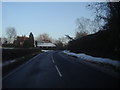
Middle Street, Nazeing
Overlooking Curtis farm
Image: © David Howard
Taken: 7 Feb 2012
0.19 miles
8
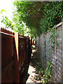
Narrow footpath off Middle Street
The public footpath runs between two back gardens, the privacy of each guarded by a high wooden fence.
Image: © Stephen Craven
Taken: 23 May 2011
0.24 miles
9
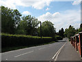
Middle Street, Lower Nazeing
This is the B194, as it comes into the built up area (there is a 30mph sign in the distance).
Image: © Stephen Craven
Taken: 23 May 2011
0.24 miles