IMAGES TAKEN NEAR TO
Sedge Green, WALTHAM ABBEY, EN9 2BF
Introduction
This page details the photographs taken nearby to Sedge Green, EN9 2BF by members of the Geograph project.
The Geograph project started in 2005 with the aim of publishing, organising and preserving representative images for every square kilometre of Great Britain, Ireland and the Isle of Man.

There are currently over 7.5m images from over14,400 individuals and you can help contribute to the project by visiting https://www.geograph.org.uk
Image Map
Images are licensed for reuse under creativecommons.org/licenses/by-sa/2.0
Notes
- Clicking on the map will re-center to the selected point.
- The higher the marker number, the further away the image location is from the centre of the postcode.
Image Listing (13 Images Found)
Images are licensed for reuse under creativecommons.org/licenses/by-sa/2.0
Image
Details
Distance
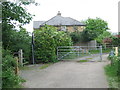
1
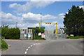
Exit from Lignacite works
Closed on a Sunday. The entrance is a little way up Meadgate Road to the left. Lignacite make concrete building blocks.
Image: © Robin Webster
Taken: 15 May 2016
0.10 miles
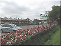
2
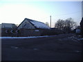
Junction of Sedge Green and Meadgate Road
Image: © David Howard
Taken: 7 Feb 2012
0.10 miles
3
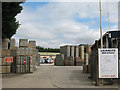
Lignacite Works, Lower Nazeing
Possibly the only industrial site in a square devoted mainly to leisure pursuits, Lignacite http://www.lignacite.co.uk make "concrete masonry products" - more commonly known as breeze blocks.
Image: © Stephen Craven
Taken: 15 Aug 2009
0.12 miles
4
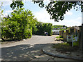
Sedge Green, Nazeing
The name of the road and the area.
Image: © Robin Webster
Taken: 15 May 2016
0.13 miles
6
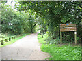
Entrance to Lee Valley Park
One of several entrances to this linear country park along the Lee/Lea Valley. This one is at Nazeing. The track forms part of National Cycle Route 1.
Image: © Stephen Craven
Taken: 15 Aug 2009
0.17 miles
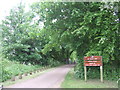
8
National Cycle Network route 1, Lea Valley
The small blue sign to the right of this image indicates the route of National Cycle Network route 1, which passes through the Lea Valley Country Park. Route 1 stretches up the east coast of Britain, from Dover to the Shetland Islands.
Image: © Malc McDonald
Taken: 1 Jun 2013
0.19 miles
10
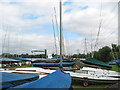
Broxbourne Sailing Club - on land
Boats on dry land to complement those on the water Image
Image: © Stephen Craven
Taken: 15 Aug 2009
0.20 miles