
IMAGES TAKEN NEAR TO
Crooked Mile, WALTHAM ABBEY, EN9 1QD
Introduction
This page details the photographs taken nearby to Crooked Mile, EN9 1QD by members of the Geograph project.
The Geograph project started in 2005 with the aim of publishing, organising and preserving representative images for every square kilometre of Great Britain, Ireland and the Isle of Man.

There are currently over 7.5m images from over14,400 individuals and you can help contribute to the project by visiting https://www.geograph.org.uk
Image Map
Images are licensed for reuse under creativecommons.org/licenses/by-sa/2.0
Notes
- Clicking on the map will re-center to the selected point.
- The higher the marker number, the further away the image location is from the centre of the postcode.
Image Listing (147 Images Found)
Images are licensed for reuse under creativecommons.org/licenses/by-sa/2.0
Image
Details
Distance
1

Swans over the Road, Waltham Cross
I believe these were formerly a pub sign.
Image: © Christine Matthews
Taken: 21 Oct 2021
0.08 miles
2
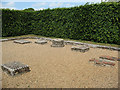
Waltham Abbey: remains of a forge
An archaeological display of the remains of a "bloomery" forge (where iron ore was smelted and then the iron used in manufacture on the same site). See also Image According to the interpretation board, it dates from around 1200CE, continued in use after the Reformation, and was re-discovered in 1974.
Image: © Stephen Craven
Taken: 23 May 2011
0.11 miles
3
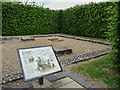
Bloomery Forge in Abbey Garden, Waltham Abbey, Essex
Waltham Abbey is a small town, which is now on the edge of London. It contains the Waltham Abbey Church said to be the final resting place of King Harold.
Image: © Christine Matthews
Taken: 16 Jun 2013
0.11 miles
4

Information Board re Bloomery Forge in Abbey Garden, Waltham Abbey, Essex
Waltham Abbey is a small town, which is now on the edge of London. It contains the Waltham Abbey Church said to be the final resting place of King Harold. Image]
Image]
Image: © Christine Matthews
Taken: 16 Jun 2013
0.11 miles
5
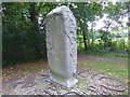
World map sculpture
This is an intriguing map in the River Lee Country Park, just north of Waltham Abbey and beyond Abbeyview. Another side can be seen at http://www.geograph.org.uk/photo/5533901
Image: © Marathon
Taken: 6 Sep 2017
0.11 miles
6
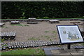
The Bloomery Forge. c1200ad. At Waltham Abbey.
Image: © Lynda Poulter
Taken: 29 Jul 2009
0.12 miles
8

Mural in Gardent, Waltham Abbey, Essex
Waltham Abbey is a small town, which is now on the edge of London. It contains the Waltham Abbey Church said to be the final resting place of King Harold.
Image: © Christine Matthews
Taken: 16 Jun 2013
0.12 miles
9

Plaque re Mural in Garden, Waltham Abbey, Essex
Waltham Abbey is a small town, which is now on the edge of London. It contains the Waltham Abbey Church said to be the final resting place of King Harold. See Image]
Image: © Christine Matthews
Taken: 16 Jun 2013
0.12 miles
10
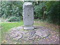
World map sculpture
This is an intriguing map in the River Lee Country Park, just north of Waltham Abbey and beyond Abbeyview. Another side can be seen at http://www.geograph.org.uk/photo/5533907
Image: © Marathon
Taken: 6 Sep 2017
0.12 miles