IMAGES TAKEN NEAR TO
Birchfield Road, WALTHAM CROSS, EN8 9PJ
Introduction
This page details the photographs taken nearby to Birchfield Road, EN8 9PJ by members of the Geograph project.
The Geograph project started in 2005 with the aim of publishing, organising and preserving representative images for every square kilometre of Great Britain, Ireland and the Isle of Man.

There are currently over 7.5m images from over14,400 individuals and you can help contribute to the project by visiting https://www.geograph.org.uk
Image Map
Images are licensed for reuse under creativecommons.org/licenses/by-sa/2.0
Notes
- Clicking on the map will re-center to the selected point.
- The higher the marker number, the further away the image location is from the centre of the postcode.
Image Listing (74 Images Found)
Images are licensed for reuse under creativecommons.org/licenses/by-sa/2.0
Image
Details
Distance
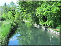
2
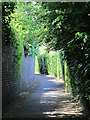
Footpath between the New River and Broomer Place, EN8
See Image
Image: © Mike Quinn
Taken: 27 May 2015
0.12 miles
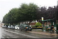
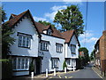
4
Churchgate Road at the junction of Goffs Lane
Image: © David Howard
Taken: 12 Apr 2012
0.13 miles
7
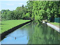
The New River east of Dewhurst Road, Churchgate, EN8 (2)
See Image
Image: © Mike Quinn
Taken: 27 May 2015
0.14 miles
8
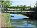
Footbridge over the New River east of Broomer Place, EN8
See Image
Image: © Mike Quinn
Taken: 27 May 2015
0.14 miles
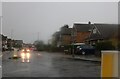
9

Churchgate / Broomer Place, EN8
Shows the location of Image
Image: © Mike Quinn
Taken: 30 Jul 2014
0.14 miles
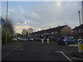
10
The New River east of Broomer Place, EN8 (2)
Image: © Mike Quinn
Taken: 27 May 2015
0.15 miles