
IMAGES TAKEN NEAR TO
Theobalds Lane, WALTHAM CROSS, EN8 8YA
Introduction
This page details the photographs taken nearby to Theobalds Lane, EN8 8YA by members of the Geograph project.
The Geograph project started in 2005 with the aim of publishing, organising and preserving representative images for every square kilometre of Great Britain, Ireland and the Isle of Man.

There are currently over 7.5m images from over14,400 individuals and you can help contribute to the project by visiting https://www.geograph.org.uk
Image Map
Images are licensed for reuse under creativecommons.org/licenses/by-sa/2.0
Notes
- Clicking on the map will re-center to the selected point.
- The higher the marker number, the further away the image location is from the centre of the postcode.
Image Listing (85 Images Found)
Images are licensed for reuse under creativecommons.org/licenses/by-sa/2.0
Image
Details
Distance
1
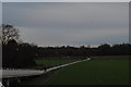
Cyclist at Cheshunt
For some reason, this chap cycled up the slope on the other side of the bridge, then got off his bike when he got to the top and - where you or I would have been unable to resist the temptation to stick out our legs and go "wheeeee" while freewheeling down the slope - carefully pushed his bike to the bottom of the ramp. I don't know why. In the background the path continues towards St Mary's School and Cheshunt.
Image: © John Winder
Taken: 9 Jan 2015
0.03 miles
2
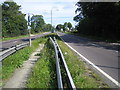
Cheshunt: A10 Great Cambridge Road
This view of an unusually deserted A10 was taken from the footpath crossing the central reservation at the Theobalds Lane junction.
Image: © Nigel Cox
Taken: 27 Aug 2007
0.05 miles
3
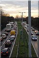
A10 traffic: looking towards Enfield
The view in the other direction from Image Friday morning rush hour near Cheshunt.
Image: © John Winder
Taken: 9 Jan 2015
0.06 miles
4
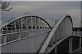
The Paul Cully Bridge, Cheshunt
The Paul Cully Bridge - named after a late local councillor who was the driving force behind the project - opened in November 2010 as part of Sustrans' "Connect2" project. As well as being part of a leisure cycle route, the bridge also provides local schoolchildren with a safe crossing of the busy A10 dual carriageway on their way to St Mary's School.
Taken with my 50mm lens, which was the only one I had with me!
Image: © John Winder
Taken: 9 Jan 2015
0.06 miles
5
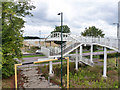
Bridge over A10
A foot and cycle bridge.
Image: © Robin Webster
Taken: 4 Sep 2015
0.06 miles
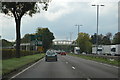
7
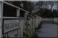
Paul Cully Bridge sign
The Paul Cully Bridge - named after a late local councillor who was the driving force behind the project - opened in November 2010 as part of Sustrans' "Connect2" project. As well as being part of a leisure cycle route, the bridge also provides local schoolchildren with a safe crossing of the busy A10 dual carriageway on their way to St Mary's School. This is a shot of the sign at the end of the bridge.
Image: © John Winder
Taken: 9 Jan 2015
0.10 miles
8
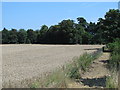
Footpath and arable farmland east of the New River
Image: © Mike Quinn
Taken: 30 Jul 2014
0.10 miles
9
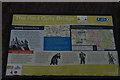
Paul Cully Bridge information board
Tells you everything you need to know about the bridge, about Sustrans and about local cycling routes, with a little public art and local history thrown in for good measure.
Image: © John Winder
Taken: 9 Jan 2015
0.11 miles
10
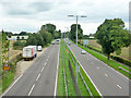
A10 looking north
Called Great Cambridge Road here.
Image: © Robin Webster
Taken: 4 Sep 2015
0.11 miles