
IMAGES TAKEN NEAR TO
Halstead Hill, WALTHAM CROSS, EN7 5NA
Introduction
This page details the photographs taken nearby to Halstead Hill, EN7 5NA by members of the Geograph project.
The Geograph project started in 2005 with the aim of publishing, organising and preserving representative images for every square kilometre of Great Britain, Ireland and the Isle of Man.

There are currently over 7.5m images from over14,400 individuals and you can help contribute to the project by visiting https://www.geograph.org.uk
Image Map
Images are licensed for reuse under creativecommons.org/licenses/by-sa/2.0
Notes
- Clicking on the map will re-center to the selected point.
- The higher the marker number, the further away the image location is from the centre of the postcode.
Image Listing (4 Images Found)
Images are licensed for reuse under creativecommons.org/licenses/by-sa/2.0
Image
Details
Distance
1
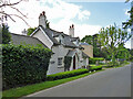
Rose Cottage on Halstead Hill
Nicely presented down below, but the dormer woodwork, particularly of the window frames, is in a poor state in this 2016 view. An early to mid 19th century grade II listed building.
Image: © Robin Webster
Taken: 24 May 2016
0.03 miles
2
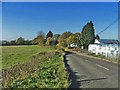
Hope Nursery, Barrow Lane, Bury Green, Hertfordshire
Hope Nursery, Barrow Lane, looking westwards towards Goffs Oak
Image: © Christine Matthews
Taken: 18 Nov 2005
0.15 miles
3
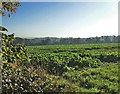
From Silver Street looking south-east towards the Theobalds Brook
Taken from Silver Street looking south-east across farmland towards Theobalds Brook
Image: © Christine Matthews
Taken: 18 Nov 2005
0.16 miles
4
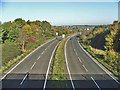
Lieutenant Ellis Way, Bury Green
Looking north from the bridge where Barrow Lane passes over the B198 Lieutenant Ellis Way, Bury Green. Are there any other B roads which are dual carriageways.
Image: © Christine Matthews
Taken: 18 Nov 2005
0.25 miles