
IMAGES TAKEN NEAR TO
Barrow Lane, WALTHAM CROSS, EN7 5LY
Introduction
This page details the photographs taken nearby to Barrow Lane, EN7 5LY by members of the Geograph project.
The Geograph project started in 2005 with the aim of publishing, organising and preserving representative images for every square kilometre of Great Britain, Ireland and the Isle of Man.

There are currently over 7.5m images from over14,400 individuals and you can help contribute to the project by visiting https://www.geograph.org.uk
Image Map
Images are licensed for reuse under creativecommons.org/licenses/by-sa/2.0
Notes
- Clicking on the map will re-center to the selected point.
- The higher the marker number, the further away the image location is from the centre of the postcode.
Image Listing (15 Images Found)
Images are licensed for reuse under creativecommons.org/licenses/by-sa/2.0
Image
Details
Distance
1
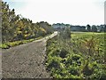
Track leading from Barrow Lane to Broadfield Farm
Track leading from Barrow Lane to Broadfield Farm looking south.
Image: © Christine Matthews
Taken: 18 Nov 2005
0.02 miles
2
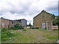
Buildings at Broadfield Farm, 2016
Footpath Cheshunt 49 threads round to the right of the large building.
Image: © Robin Webster
Taken: 24 May 2016
0.03 miles
3
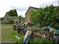
Junk at Broadfield Farm
Looking from footpath Cheshunt 49, which now skirts the rest of the farmyard to the east beside the B198 fence, although indications are it used to go through the middle of the yard.
Image: © Robin Webster
Taken: 24 May 2016
0.05 miles
4
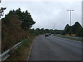
Lay-by on the B198
Appears to be a popular place for fly tipping.
Image: © JThomas
Taken: 27 Jul 2019
0.07 miles
7
Piebald horse in the countryside from Lieut Ellis Way
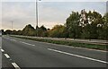
The layby on this bypass road allows one to stop and savour the countryside. But the litter which manages to avoid the single bin makes it a very unpleasant stay.
Image: © Jack Hill
Taken: 9 Aug 2005
0.11 miles
8
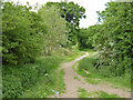
Footpath Cheshunt 49 crosses Theobalds Brook
On the way to Broadfield Farm. The brook is well hidden by the bushes, so not at all photogenic.
Image: © Robin Webster
Taken: 24 May 2016
0.12 miles
9
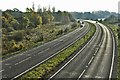
Lieutenant Ellis Way, Bury Green
Looking south from the bridge where Barrow Lane passes over Lieutenant Ellis Way (the B198), Bury Green, Hertfordshire, towards Broom Hills.
Image: © Christine Matthews
Taken: 18 Nov 2005
0.12 miles
10
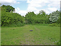
Footpath Cheshunt 49 approaches crossing of Theobalds Brook
On the way to Broadfield Farm. The brook is well hidden by the bushes, so not at all photogenic. The object on the ground is a car tyre.
Image: © Robin Webster
Taken: 24 May 2016
0.12 miles