
IMAGES TAKEN NEAR TO
Burnt Farm Ride, WALTHAM CROSS, EN7 5JA
Introduction
This page details the photographs taken nearby to Burnt Farm Ride, EN7 5JA by members of the Geograph project.
The Geograph project started in 2005 with the aim of publishing, organising and preserving representative images for every square kilometre of Great Britain, Ireland and the Isle of Man.

There are currently over 7.5m images from over14,400 individuals and you can help contribute to the project by visiting https://www.geograph.org.uk
Image Map
Images are licensed for reuse under creativecommons.org/licenses/by-sa/2.0
Notes
- Clicking on the map will re-center to the selected point.
- The higher the marker number, the further away the image location is from the centre of the postcode.
Image Listing (12 Images Found)
Images are licensed for reuse under creativecommons.org/licenses/by-sa/2.0
Image
Details
Distance
3
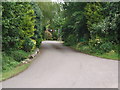
Entrance to Burnt Farm
This is on the Theobalds Park Estate.
Image: © Bikeboy
Taken: 10 Jun 2012
0.05 miles
4
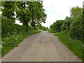
Burnt Farm Ride
The surface changes here, tarmac northwards, just 'mac' to the south. Public bridleway Cheshunt 17.
Image: © Robin Webster
Taken: 24 May 2016
0.06 miles
5
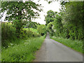
Burnt Farm Ride
A private tarmac road as far as Burnt Farm, thereafter a well surfaced track. Public bridleway Cheshunt 17.
Image: © Robin Webster
Taken: 24 May 2016
0.08 miles
6
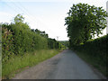
Burntfarm Ride
Burntfarm Ride is a bridleway that runs dead straight for 1.6km (1 mile) south of this summit. There are hedges either side.
Image: © Stephen Craven
Taken: 4 Jun 2011
0.11 miles
8
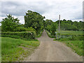
Crossways south of Burnt Farm
Burnt Farm Ride runs left and right, bridleway Cheshunt 17 to the left, bridleway Cheshunt 70 to the right. Straight on beyond the junction is bridleway Cheshunt 73. Viewed from footpath Cheshunt 59.
Image: © Robin Webster
Taken: 24 May 2016
0.15 miles
10
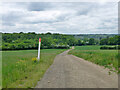
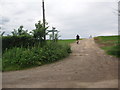
Farm track crosses gas pipeline
The track is public footpath Cheshunt 59.
Image: © Robin Webster
Taken: 24 May 2016
0.19 miles