
IMAGES TAKEN NEAR TO
Cuffley Hill, WALTHAM CROSS, EN7 5HE
Introduction
This page details the photographs taken nearby to Cuffley Hill, EN7 5HE by members of the Geograph project.
The Geograph project started in 2005 with the aim of publishing, organising and preserving representative images for every square kilometre of Great Britain, Ireland and the Isle of Man.

There are currently over 7.5m images from over14,400 individuals and you can help contribute to the project by visiting https://www.geograph.org.uk
Image Map
Images are licensed for reuse under creativecommons.org/licenses/by-sa/2.0
Notes
- Clicking on the map will re-center to the selected point.
- The higher the marker number, the further away the image location is from the centre of the postcode.
Image Listing (22 Images Found)
Images are licensed for reuse under creativecommons.org/licenses/by-sa/2.0
Image
Details
Distance
1
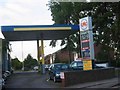
Garage at junction in Goff's Oak
It will be interesting to see how the cost of petrol rises over the years to come.
Image: © Jack Hill
Taken: 9 Aug 2005
0.04 miles
2
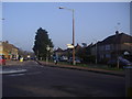
Mini roundabout on Cuffley Hill, Goffs Oak
Image: © David Howard
Taken: 2 Mar 2011
0.05 miles
5
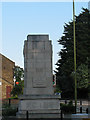
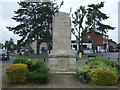
Goff's Oak - war memorial
The village war memorial is in a severe architectural style, made of large blocks of Portland stone.
The memorial was restored in 2008, according to the National Inventory of War Memorials http://www.ukniwm.org.uk/ - ref. 1127
Image: © Stephen Craven
Taken: 4 Jun 2011
0.08 miles
6
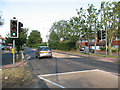
Pelican crossing on Cuffley Hill
Cuffley Hill is the B156. The crossing is near the junction with Jones Road.
Image: © Stephen Craven
Taken: 4 Jun 2011
0.08 miles
8
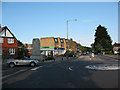
Junction of Goff's Lane and Newgatestreet Road
A mini-roundabout marks the junction.
Image: © Stephen Craven
Taken: 4 Jun 2011
0.09 miles
10
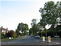
Jones Road
Jones Road is the name of a suburban street which becomes Burntfarm Ride (bridleway) further south.
Image: © Stephen Craven
Taken: 4 Jun 2011
0.09 miles