
IMAGES TAKEN NEAR TO
Little Foxes, Goose Green, HODDESDON, EN11 8SR
Introduction
This page details the photographs taken nearby to Little Foxes, Goose Green, EN11 8SR by members of the Geograph project.
The Geograph project started in 2005 with the aim of publishing, organising and preserving representative images for every square kilometre of Great Britain, Ireland and the Isle of Man.

There are currently over 7.5m images from over14,400 individuals and you can help contribute to the project by visiting https://www.geograph.org.uk
Image Map
Images are licensed for reuse under creativecommons.org/licenses/by-sa/2.0
Notes
- Clicking on the map will re-center to the selected point.
- The higher the marker number, the further away the image location is from the centre of the postcode.
Image Listing (12 Images Found)
Images are licensed for reuse under creativecommons.org/licenses/by-sa/2.0
Image
Details
Distance
1
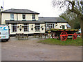
The Huntsman, Goose Green
The pub was known as the Green Man years ago.
Image: © Melvyn Cousins
Taken: 10 Mar 2006
0.03 miles
3
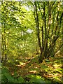
Hornbeams in Hoddesdonpark Wood
Coppiced woodland, largely hornbeam, managed as part of the Broxbourne Woods National Nature Reserve. The tree nearest the camera is an old coppiced hornbeam - though a good many years must have passed since it was last coppiced.
http://jncc.defra.gov.uk/protectedsites/sacselection/sac.asp?EUCode=UK0013696
Image: © Stefan Czapski
Taken: 7 Jun 2014
0.08 miles
4

Old coppiced hornbeam, Hoddesdonpark Wood
A somewhat grotesque specimen, growing on a bank which runs roughly parallel to the lane (Lord Street) that skirts the northern edge of the wood.
Image: © Stefan Czapski
Taken: 7 Jun 2014
0.11 miles
5
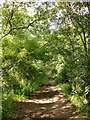
Bridleway by Ermine Street, north of Lord Street
View north toward Hertford Heath - and eventually Lincoln and York. At this point the bridleway runs close to and parallel with Ermine Street, but the ancient alignment is less distinct here than it is south of Lord Street http://www.geograph.org.uk/photo/3427466 http://www.geograph.org.uk/photo/4018273 lying overgrown in the woodland just to the east of the right of way.
Image: © Stefan Czapski
Taken: 6 Jul 2014
0.20 miles
6
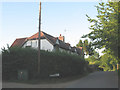
Houses near Goose Green
A few isolated houses on Lord Street.
Image: © Stephen Craven
Taken: 4 Jun 2011
0.21 miles
7
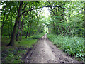
Elbow Lane
A restricted byway along the course of the Roman Ermine Street.
Image: © Robin Webster
Taken: 9 Jul 2016
0.22 miles
8
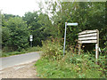
Ermine Street crosses Mangrove Lane
There is a small car park here.
Image: © Robin Webster
Taken: 21 Aug 2015
0.22 miles
9
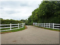
Entrance, East Herts Equestrian Centre
Image: © Robin Webster
Taken: 21 Aug 2015
0.24 miles
10
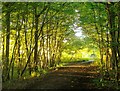
Ermine Street south of Lord Street
A shot taken in the first week of June, looking north toward Lord Street.
Ermine Street originated as a Roman road, but served for many centuries as a drove road - for livestock being herded south to London. For a few miles in this part of Hertfordshire it runs through hornbeam woods. http://www.geograph.org.uk/photo/3424660
Image: © Stefan Czapski
Taken: 7 Jun 2014
0.24 miles