IMAGES TAKEN NEAR TO
Grosvenor Road, BROXBOURNE, EN10 7JG
Introduction
This page details the photographs taken nearby to Grosvenor Road, EN10 7JG by members of the Geograph project.
The Geograph project started in 2005 with the aim of publishing, organising and preserving representative images for every square kilometre of Great Britain, Ireland and the Isle of Man.

There are currently over 7.5m images from over14,400 individuals and you can help contribute to the project by visiting https://www.geograph.org.uk
Image Map (Loading...)


Getting Data...Please wait
Leaflet Map data © OpenStreetMap
Images are licensed for reuse under creativecommons.org/licenses/by-sa/2.0
Notes
- Clicking on the map will re-center to the selected point.
- The higher the marker number, the further away the image location is from the centre of the postcode.
Image Listing (69 Images Found)
Images are licensed for reuse under creativecommons.org/licenses/by-sa/2.0
Image
Details
Distance
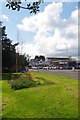
1
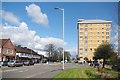
A1170 in Broxbourne
At the junction with Station Road.
Image: © Glyn Baker
Taken: 23 Apr 2016
0.05 miles
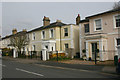
2
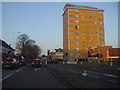
Flats on High Road Broxbourne
On the corner of Station Road
Image: © David Howard
Taken: 7 Feb 2012
0.09 miles
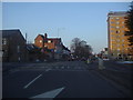
3
Station Road, Broxbourne
At the junction of High Road
Image: © David Howard
Taken: 7 Feb 2012
0.10 miles
5
Broxbourne Herts.
Looking across the High Road.
Image: © Glyn Baker
Taken: 23 Apr 2016
0.11 miles
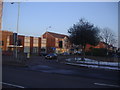
6
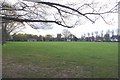
Broxbourne Rec
This recreation ground was established by act of parliament in 1890.
Image: © Glyn Baker
Taken: 23 Apr 2016
0.11 miles
8

Telephone Exchange, Broxbourne (2)
Taken from St Michael's Road, this photo shows the extension to the TE with the four red rubbish bins in front of it and mobile phone antennae on its roof. Also, two pale green generators can be seen to the right of the photo. This TE is one of nine in the Lea Valley (01992) group and its postcode is EN10 7HU.
Image: © David Hillas
Taken: 29 Sep 2019
0.15 miles
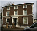
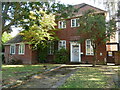
9
C19 villas in Churchfields, Broxbourne
This group of houses date from 1840.
Image: © David Kemp
Taken: 11 Mar 2017
0.16 miles
10
Telephone Exchange, Broxbourne (1)
Situated on the A1170 High Road, this TE used to take the name Hoddesdon nearby and has the code LNHOD. It provides telephone and broadband services to 16,630 residential and 741 non-residential premises in Broxbourne, Hoddesdon and Turnford. This redbrick building rather resembles an ornate house with the words TELEPHONE EXCHANGE above its front door. The extension to the TE can just be seen behind the gate to the right of the photo.
Image: © David Hillas
Taken: 29 Sep 2019
0.16 miles