IMAGES TAKEN NEAR TO
The Oval, BROXBOURNE, EN10 6DQ
Introduction
This page details the photographs taken nearby to The Oval, EN10 6DQ by members of the Geograph project.
The Geograph project started in 2005 with the aim of publishing, organising and preserving representative images for every square kilometre of Great Britain, Ireland and the Isle of Man.

There are currently over 7.5m images from over14,400 individuals and you can help contribute to the project by visiting https://www.geograph.org.uk
Image Map (Loading...)


Getting Data...Please wait
Leaflet Map data © OpenStreetMap
Images are licensed for reuse under creativecommons.org/licenses/by-sa/2.0
Notes
- Clicking on the map will re-center to the selected point.
- The higher the marker number, the further away the image location is from the centre of the postcode.
Image Listing (53 Images Found)
Images are licensed for reuse under creativecommons.org/licenses/by-sa/2.0
Image
Details
Distance
1
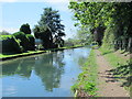
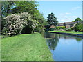
The New River west of High Road, Turnford, EN10 (3)
See Image
Image: © Mike Quinn
Taken: 27 May 2015
0.02 miles
2
The New River west of High Road, Turnford, EN10 (2)
See Image
Image: © Mike Quinn
Taken: 27 May 2015
0.03 miles
3
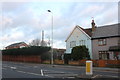
Houses bordering the New River, Turnford
The houses are situated in The Oval. The fallen tree effectively blocked the path and dammed the New River.
Image: © David Kemp
Taken: 19 Dec 2015
0.03 miles
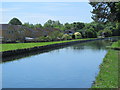
4
The New River and embankment west of The Oval, EN10 (3)
See Image
Image: © Mike Quinn
Taken: 27 May 2015
0.04 miles
5
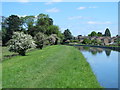
The New River and embankment west of The Oval, EN10
Image: © Mike Quinn
Taken: 27 May 2015
0.04 miles
6
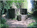
WWII pillbox by the New River west of The Oval, EN10
Image: © Mike Quinn
Taken: 27 May 2015
0.05 miles
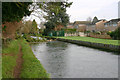
7
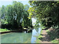
The New River west of The Oval, EN10 (2)
See Image
Image: © Mike Quinn
Taken: 27 May 2015
0.06 miles
8
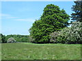
Field and woodland west of the New River
Image: © Mike Quinn
Taken: 27 May 2015
0.07 miles
9
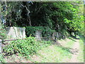
Row of WWII concrete blocks by the New River
Just to the north of the Image
Image: © Mike Quinn
Taken: 27 May 2015
0.07 miles