
IMAGES TAKEN NEAR TO
Rankin Drive, EDINBURGH, EH9 3DG
Introduction
This page details the photographs taken nearby to Rankin Drive, EH9 3DG by members of the Geograph project.
The Geograph project started in 2005 with the aim of publishing, organising and preserving representative images for every square kilometre of Great Britain, Ireland and the Isle of Man.

There are currently over 7.5m images from over14,400 individuals and you can help contribute to the project by visiting https://www.geograph.org.uk
Image Map
Images are licensed for reuse under creativecommons.org/licenses/by-sa/2.0
Notes
- Clicking on the map will re-center to the selected point.
- The higher the marker number, the further away the image location is from the centre of the postcode.
Image Listing (69 Images Found)
Images are licensed for reuse under creativecommons.org/licenses/by-sa/2.0
Image
Details
Distance
1

Rankin Drive
Once the fields of Liberton West Mains Farm (steadings were at the northwest corner of what is now the King's Buildings campus.)
Image: © Richard Webb
Taken: 20 Jun 2021
0.01 miles
2

Flats, Rankin Drive
Once the fields of Liberton West Mains Farm (steadings were at the northwest corner of what is now the King's Buildings campus.)
Image: © Richard Webb
Taken: 20 Jun 2021
0.03 miles
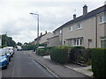
4

Rankin Drive
Once the fields of Liberton West Mains Farm (steadings were at the northwest corner of what is now the King's Buildings campus.)
Image: © Richard Webb
Taken: 20 Jun 2021
0.05 miles
5

Junction, Langton Road and West Mains Road
Outside King's Buildings.
Image: © Richard Webb
Taken: 15 Mar 2014
0.07 miles
6
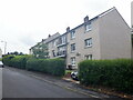
Flats, Langton Road
Once the fields of Liberton West Mains Farm (steadings were at the northwest corner of what is now the King's Buildings campus.)
Image: © Richard Webb
Taken: 20 Jun 2021
0.07 miles
7

Arch at the lower end of Observatory Road
This arch is the start of the relatively steep Observatory Road which as the name indicates leads to the Royal Observatory on Blackford Hill.
The arch commemorates the work of George Harrison (1812 - 1885).
Image: © G Laird
Taken: 17 Oct 2008
0.08 miles
9

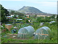
Monumental arch, Observatory Road
Monument at the foot of the road leading to Edinburgh University's observatory and the Blackford Hill. The arch was erected in 1888 to commemorate 'the work and character' of George Harrison MP (1812-1885) 'whose life was devoted to the public good'. Sir George was a Lord Provost of the city.
Image: © Kay Williams
Taken: 3 Jan 2010
0.08 miles
10

Observatory Road
The archway at the foot of Observatory Road commemorates Lord Provost Sir George Harrison (died 1885), who was the prime mover in acquiring Blackford Hill as a public park. It was designed by Arthur George Sydney Mitchell and erected in 1887.
Image: © Anne Burgess
Taken: 23 Mar 2014
0.08 miles