
IMAGES TAKEN NEAR TO
West Mains Road, EDINBURGH, EH9 3BQ
Introduction
This page details the photographs taken nearby to West Mains Road, EH9 3BQ by members of the Geograph project.
The Geograph project started in 2005 with the aim of publishing, organising and preserving representative images for every square kilometre of Great Britain, Ireland and the Isle of Man.

There are currently over 7.5m images from over14,400 individuals and you can help contribute to the project by visiting https://www.geograph.org.uk
Image Map
Images are licensed for reuse under creativecommons.org/licenses/by-sa/2.0
Notes
- Clicking on the map will re-center to the selected point.
- The higher the marker number, the further away the image location is from the centre of the postcode.
Image Listing (78 Images Found)
Images are licensed for reuse under creativecommons.org/licenses/by-sa/2.0
Image
Details
Distance
1

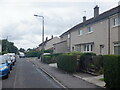
Flats, Rankin Drive
Once the fields of Liberton West Mains Farm (steadings were at the northwest corner of what is now the King's Buildings campus.)
Image: © Richard Webb
Taken: 20 Jun 2021
0.04 miles
3

Rankin Drive
Once the fields of Liberton West Mains Farm (steadings were at the northwest corner of what is now the King's Buildings campus.)
Image: © Richard Webb
Taken: 20 Jun 2021
0.04 miles
4

Junction, Langton Road and West Mains Road
Outside King's Buildings.
Image: © Richard Webb
Taken: 15 Mar 2014
0.05 miles
5

Edinburgh Harley-Davidson
Business premises on West Mains Road.
Image: © Leslie Barrie
Taken: 31 Aug 2013
0.07 miles
6

Murchison House
Former headquarters of the British Geological Survey. Murchison House has been recently refurbished by The University of Edinburgh to provide office accommodation.
Image: © Graeme Yuill
Taken: 28 Sep 2019
0.07 miles
7

Rankin Drive
Once the fields of Liberton West Mains Farm (steadings were at the northwest corner of what is now the King's Buildings campus.)
Image: © Richard Webb
Taken: 20 Jun 2021
0.07 miles
8
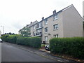
Flats, Langton Road
Once the fields of Liberton West Mains Farm (steadings were at the northwest corner of what is now the King's Buildings campus.)
Image: © Richard Webb
Taken: 20 Jun 2021
0.09 miles
9

Arch at the lower end of Observatory Road
This arch is the start of the relatively steep Observatory Road which as the name indicates leads to the Royal Observatory on Blackford Hill.
The arch commemorates the work of George Harrison (1812 - 1885).
Image: © G Laird
Taken: 17 Oct 2008
0.09 miles
10
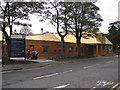
Nursery at the King's Buildings
A new and recently opened nursery at the University of Edinburgh. Designed by Malcolm Fraser Architects, it is strikingly clad in copper and wood [it smells lovely!].
Image: © M J Richardson
Taken: 16 Oct 2014
0.09 miles