
IMAGES TAKEN NEAR TO
Mountcastle Drive North, EDINBURGH, EH8 7SJ
Introduction
This page details the photographs taken nearby to Mountcastle Drive North, EH8 7SJ by members of the Geograph project.
The Geograph project started in 2005 with the aim of publishing, organising and preserving representative images for every square kilometre of Great Britain, Ireland and the Isle of Man.

There are currently over 7.5m images from over14,400 individuals and you can help contribute to the project by visiting https://www.geograph.org.uk
Image Map
Images are licensed for reuse under creativecommons.org/licenses/by-sa/2.0
Notes
- Clicking on the map will re-center to the selected point.
- The higher the marker number, the further away the image location is from the centre of the postcode.
Image Listing (74 Images Found)
Images are licensed for reuse under creativecommons.org/licenses/by-sa/2.0
Image
Details
Distance
1
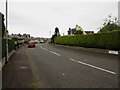
Mountcastle Terrace, Edinburgh
Mountcastle Terrace, a residential street to the south east of Edinburgh city centre.
Image: © Graham Robson
Taken: 24 May 2014
0.02 miles
2

Mountcastle Terrace
Post war development. This western side of the three semicircular roads appears on 1947 mapping. The other halves of the arcs do not appear until much later (not shown in 1955) and houses at the other end of the semicircular roads look much younger.
Image: © Richard Webb
Taken: 13 Mar 2025
0.04 miles
3
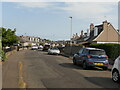
Mountcastle Crescent
The outermost of three concentric arcs of residential streets. Maps suggest that construction was during the immediate post World War II years on Northfield Farm land.
Image: © Richard Webb
Taken: 10 Sep 2023
0.06 miles
4
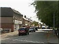
Northfield Farm Road
Northfield Farm Road predates the mid 20th century housing and was literally a road to Northfield Farm which occupied the area.
Image: © Richard Webb
Taken: 10 Sep 2023
0.06 miles
5

Path, Northfield
Cuts an acute corner between Northfield Farm Road and Northfield Broadway.
Image: © Richard Webb
Taken: 7 Aug 2024
0.06 miles
6

Northfield Broadway
1920s expansion of Edinburgh following reorganisation of boundaries. At this time the city started to fill the gap with the town of Portobello. Now it is filling gaps with Tranent and Prestonpans.
Image: © Richard Webb
Taken: 1 Jul 2024
0.07 miles
7
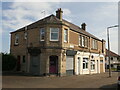
Corner building, Moutcastle Drive North
Amber Hair and Beauty: there have been hairdressers under differing names in this property for some time. Presumably there were originally shops here.
Image: © Richard Webb
Taken: 10 Sep 2023
0.07 miles
8

Mountcastle Crescent
The outermost of three concentric arcs of residential streets. Maps suggest that construction was during the immediate post World War II years on Northfield Farm land.
Image: © Richard Webb
Taken: 10 Sep 2023
0.07 miles
9

53 Northfield Broadway
There is a triangle of greenery in the foreground. Northfield is named after the farm that was here until the 20th century.
Image: © Richard Webb
Taken: 1 Jul 2024
0.08 miles
10

Mountcastle Gardens
The innermost semicircle. Like the two outer roads, this western side was completed first, appearing on maps by 1947, followed by the eastern part in the 1950s with a middle section being built upon later. The mapping evidence is reflected in the styles of housing here.
Image: © Richard Webb
Taken: 13 Mar 2025
0.09 miles