
IMAGES TAKEN NEAR TO
Northfield Broadway, EDINBURGH, EH8 7QE
Introduction
This page details the photographs taken nearby to Northfield Broadway, EH8 7QE by members of the Geograph project.
The Geograph project started in 2005 with the aim of publishing, organising and preserving representative images for every square kilometre of Great Britain, Ireland and the Isle of Man.

There are currently over 7.5m images from over14,400 individuals and you can help contribute to the project by visiting https://www.geograph.org.uk
Image Map
Images are licensed for reuse under creativecommons.org/licenses/by-sa/2.0
Notes
- Clicking on the map will re-center to the selected point.
- The higher the marker number, the further away the image location is from the centre of the postcode.
Image Listing (66 Images Found)
Images are licensed for reuse under creativecommons.org/licenses/by-sa/2.0
Image
Details
Distance
1

Northfield Broadway
Number 4 bus on the way out to Queen Margaret University.
Image: © Richard Webb
Taken: 7 Aug 2024
0.03 miles
2

Northfield Broadway
1920s expansion of Edinburgh following reorganisation of boundaries. At this time the city started to fill the gap with the town of Portobello. Now it is filling gaps with Tranent and Prestonpans.
Image: © Richard Webb
Taken: 1 Jul 2024
0.04 miles
3

Path, Northfield
Cuts an acute corner between Northfield Farm Road and Northfield Broadway.
Image: © Richard Webb
Taken: 7 Aug 2024
0.05 miles
4

53 Northfield Broadway
There is a triangle of greenery in the foreground. Northfield is named after the farm that was here until the 20th century.
Image: © Richard Webb
Taken: 1 Jul 2024
0.06 miles
5
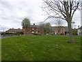
Northfield Circus
A circular end to a no through road.
Image: © Richard Webb
Taken: 23 Apr 2016
0.07 miles
6

The view from Meadowfield Park
A green space on the lower slopes of Holyrood Park, looking over housing at Willowbrae and Northfield towards Portobello.
Image: © M J Richardson
Taken: 3 Aug 2008
0.08 miles
7

Looking east from Meadowfield Drive
There are good views from the lower eastern slopes of Holyrood Park. The long grey 'sheds' in the middle distance are part of the railway infrastructure. The two chimneys to the right belong to the Cockenzie Power Station, and North Berwick Law is on the left hand horizon, 30 km away.
Image: © M J Richardson
Taken: 3 Aug 2008
0.09 miles
8

Northfield Square
Very close to the site of Northfield Farm's house and steadings.
Image: © Richard Webb
Taken: 22 Aug 2025
0.10 miles
9
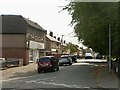
Northfield Farm Road
Northfield Farm Road predates the mid 20th century housing and was literally a road to Northfield Farm which occupied the area.
Image: © Richard Webb
Taken: 10 Sep 2023
0.10 miles
10

Path from Northfield Square
The roads in Northfield are joined by paths, unlike the annoying late 20th century practice of not allowing easy movement through a suburb on foot. I once lived next to a bus stop but had an 800m walk to it when the connecting path was blocked. (Walsall).
Image: © Richard Webb
Taken: 22 Aug 2025
0.11 miles