
IMAGES TAKEN NEAR TO
Willowbrae Road, EDINBURGH, EH8 7NG
Introduction
This page details the photographs taken nearby to Willowbrae Road, EH8 7NG by members of the Geograph project.
The Geograph project started in 2005 with the aim of publishing, organising and preserving representative images for every square kilometre of Great Britain, Ireland and the Isle of Man.

There are currently over 7.5m images from over14,400 individuals and you can help contribute to the project by visiting https://www.geograph.org.uk
Image Map
Images are licensed for reuse under creativecommons.org/licenses/by-sa/2.0
Notes
- Clicking on the map will re-center to the selected point.
- The higher the marker number, the further away the image location is from the centre of the postcode.
Image Listing (57 Images Found)
Images are licensed for reuse under creativecommons.org/licenses/by-sa/2.0
Image
Details
Distance
2

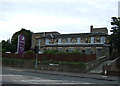
Duddingston : Willowbrae Road A1
Heading along Willowbrae Road.
Image: © Lewis Clarke
Taken: 23 Sep 2020
0.03 miles
3

Duddingston Mills
Duddingston Mills was a small village at the crossroads where Willowbrae Road meets Duddingston Road. The older houses are still here, probably unappreciated by those waiting for the lights on the busy roads. Something is being built on what was the forecourt of a car showroom.
Image: © Richard Webb
Taken: 1 Jul 2024
0.04 miles


6

Cauvin's Hospital, Willowbrae Road
House of Louis Cauvin, son of a French Huguenot officer who fled France in the 1740s or 50s following a fatal duelling incident. The young Louis made his fortune teaching French in Edinburgh. On retiring he became the tenant of Woodlands Farm, Duddingston and built his new house called 'Louisville' opposite the farm on the road to Jock's Lodge. Before his death in 1824 he bequeathed a hospital to provide for the maintenance and education of 20 boys between the ages of six and eight for a period of six years. The scholars were to be the sons of teachers and farmers (failing which, master printers, booksellers or farm servants). A bias towards languages was reflected in the curriculum which, beside the three 'R's and Mathematics, comprised Latin, Greek, French and German. It opened in 1833 and was administered by trustees, including the Lord Provost, the Principal of the University, the Rector of the High School, the Ministers of Duddingston and Liberton and the factor of the chief local landowner, the Duke of Abercorn. The building is now the centrepiece of housing for the elderly.
Image
Image: © kim traynor
Taken: 15 Dec 2009
0.05 miles
7

'Louisfield', Willowbrae Road
Formerly Cauvin's Hospital, the house now stands at the centre of a small, modern housing development for the elderly.
Image
Image: © kim traynor
Taken: 15 Dec 2009
0.05 miles
9

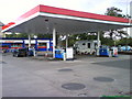
Site awaiting development, Northfield Broadway
At the junction with Willowbrae Road. Previously the site of a bar and/or restaurant with a variety of names: Right Wing (how attractive), Republik and Radical Road. Like the real Radical Road it is behind an ugly fence. Nothing seems to have happened here since 2019 other than visits from criminals with spray cans. (One of these has been around so long, I would have though it would have grown up or learned to spray by now).
Image: © Richard Webb
Taken: 1 Jul 2024
0.06 miles
10

Willowbrae Road
The A1 since the 1950s, seen from Northfield Broadway. The filling station (July 2024) was selling unleaded at £1.44 and diesel at £1.48. There was the usual surcharge you now get in Edinburgh (on just about everything). The long boarded up site of the Radical Road public house is on the left.
Image: © Richard Webb
Taken: 1 Jul 2024
0.06 miles