
IMAGES TAKEN NEAR TO
Dicksonfield, EDINBURGH, EH7 5NE
Introduction
This page details the photographs taken nearby to Dicksonfield, EH7 5NE by members of the Geograph project.
The Geograph project started in 2005 with the aim of publishing, organising and preserving representative images for every square kilometre of Great Britain, Ireland and the Isle of Man.

There are currently over 7.5m images from over14,400 individuals and you can help contribute to the project by visiting https://www.geograph.org.uk
Image Map
Images are licensed for reuse under creativecommons.org/licenses/by-sa/2.0
Notes
- Clicking on the map will re-center to the selected point.
- The higher the marker number, the further away the image location is from the centre of the postcode.
Image Listing (322 Images Found)
Images are licensed for reuse under creativecommons.org/licenses/by-sa/2.0
Image
Details
Distance
1

Dicksonfield
New housing off Leith Walk.
Image: © Richard Webb
Taken: 2 Dec 2016
0.03 miles
2

Construction, Brunswick Road
Flats being built on the site of the Post Office depot.
Image: © Richard Webb
Taken: 2 Dec 2016
0.04 miles
3

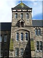
Leith Walk School
"Northward of Windsor Street, in what was once a narrow, pleasant, and secluded path between thick hedgerows, called the Lover's Loan, was built, in 1876, at a short distance from the railway station, the Leith Walk public school, at a cost of £9,000; it is in the Decorated Collegiate style, calculated to accommodate about 840 scholars, and is a good specimen of the Edinburgh Board schools." – James Grant, Old And New Edinburgh, vol.iii, 1883
Image: © kim traynor
Taken: 25 Aug 2011
0.06 miles
4

Shop, Leith Walk
French clothing and interiors shop, beautifully decorated.
Image: © Richard Webb
Taken: 7 Aug 2022
0.06 miles
5
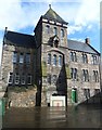
Leith Walk School from the playground
In the 1950s, pupils lined up in this playground every morning at the beginning of the school day. On hearing the bell, they arranged themselves by class in rows of two, before awaiting the arrival of the teacher on duty who would insist on straight rows and complete silence before allowing them to enter the building. On occasion, the 'belt' (tawse) would be threatened against anyone misbehaving on entering. Changed days!
Image: © kim traynor
Taken: 25 Aug 2011
0.06 miles
7

Murano Place
Parallel to the nearby Leith Walk. There is a railway at the end, now disused since the Powderhall Waste Transfer Station closed.
Image: © Richard Webb
Taken: 7 Oct 2019
0.06 miles
8

Edinburgh School Board emblem
Sculpture on the wall of Leith Walk Primary School, ingrained with over a century of soot from the steam shunting locomotives that used to operate in the adjacent North British Goods Yard.
Image
Image: © kim traynor
Taken: 25 Aug 2011
0.06 miles
9

New flats, Brunswick Road
Housing being built on the site of the Post Office depot.
Image: © Richard Webb
Taken: 2 Dec 2016
0.06 miles
10

Tramworks, Leith Walk
Leith Walk was dug up originally for rerouting utilities around 2008-09 but the scheme was abandoned before track laying and the line stopped at the now closed York Place tram stop. Tracks are now being laid to Newhaven, finally completing Line 1.
Image: © Richard Webb
Taken: 1 Feb 2022
0.06 miles