
IMAGES TAKEN NEAR TO
Brunswick Place, EDINBURGH, EH7 5HP
Introduction
This page details the photographs taken nearby to Brunswick Place, EH7 5HP by members of the Geograph project.
The Geograph project started in 2005 with the aim of publishing, organising and preserving representative images for every square kilometre of Great Britain, Ireland and the Isle of Man.

There are currently over 7.5m images from over14,400 individuals and you can help contribute to the project by visiting https://www.geograph.org.uk
Image Map
Images are licensed for reuse under creativecommons.org/licenses/by-sa/2.0
Notes
- Clicking on the map will re-center to the selected point.
- The higher the marker number, the further away the image location is from the centre of the postcode.
Image Listing (357 Images Found)
Images are licensed for reuse under creativecommons.org/licenses/by-sa/2.0
Image
Details
Distance
1

Tram works in Leith Walk
Completing the line from the airport which was only originally built as far as York Place.
Image: © Richard Webb
Taken: 29 Jun 2022
0.02 miles


4
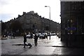
Leith Walk and McDonald Road
From the junction with McDonald Road.
Image: © Richard Webb
Taken: 13 Nov 2015
0.02 miles
5
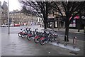
Bike stand, Brunswick Street
Edinburgh now has a velo lib scheme.
Image: © Richard Webb
Taken: 6 Jan 2019
0.02 miles
6

Brunswick Road from Macdonald Road
An unexpected glimpse of the slopes of Arthur's Seat behind London Road Church in the distance. A few yards off to the left is Shrubhill, once the site of a gibbet known as the Gallow Lee, in use until the late 17th century. The bodies of malefactors (or just their limbs) were hanged here in chains on the road between Edinburgh and Leith as a deterrent to others. In 1664, nine women accused of witchcraft were strangled and burnt on the spot. In 1678, five similarly accused women met the same fate. Covenanters were also executed here during "The Killing Time" in the 1680s. http://www.geograph.org.uk/photo/2384828 For example, the body of David Hackston was hung in chains here after his execution at the Cross in Edinburgh in 1681. http://www.geograph.org.uk/photo/1367417 It was also the site, in 1697, of the last execution for blasphemy in Scotland. http://www.geograph.org.uk/photo/2147453 Local worthies complained in 1751 that "nothing but the neighbourhood of the gibbet hinders the locality from being distinguished by a frequency of country houses" and urged the Council to relocate it to the east end of Leith Links. The magistrates consented, but the Leithers quickly retaliated by protesting that the gibbet was on "the most publick high road in Scotland and where it has been fixt for a century". They won the argument and the decision was overturned by the Lords of Justiciary. The ground, now flattened, can be seen here http://www.geograph.org.uk/photo/1837429
Before it was renamed in the early 19th century, Brunswick Road was called Lovers Loan. The road is very old and appears clearly on the Siege of Leith Map of 1560; although originally it did not bend round to the north, as it does today, but to the south to reach Abbeyhill. I remember, as a child, an elderly relative recalling how before the Great War she watched a German Band with a dancing bear performing on this corner of the road where the cream-coloured building stands. It was once a furniture and household goods shop with the larger items priced in guineas. Now it's a Tesco Express.
Image: © kim traynor
Taken: 25 Aug 2011
0.02 miles
7
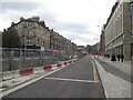
Tram line construction, Leith Walk
There is a one way system with traffic only being allowed uphill (towards Edinburgh) Leith bound buses are using Easter Road.
Image: © Richard Webb
Taken: 14 Feb 2022
0.02 miles
8

Leith Walk
The tram works have finished here and the fences have come down. Work was still taking place towards the Edinburgh end and further north into Leith, past the Pilrig Kirk.
Image: © Richard Webb
Taken: 7 Aug 2022
0.02 miles
9

Leith Walk and McDonald Road
Junction on Leith Walk.
Image: © Richard Webb
Taken: 13 Nov 2015
0.02 miles
10

Tram works, Leith Walk
Leith Walk was dug up originally for rerouting utilities around 2008-09 but the scheme was abandoned and the tracks stopped at the now closed York Place tram stop. Tracks are now being laid to Newhaven, finally completing Line 1.
Image: © Richard Webb
Taken: 1 Feb 2022
0.02 miles