
IMAGES TAKEN NEAR TO
Prospect Bank Gardens, EDINBURGH, EH6 7PA
Introduction
This page details the photographs taken nearby to Prospect Bank Gardens, EH6 7PA by members of the Geograph project.
The Geograph project started in 2005 with the aim of publishing, organising and preserving representative images for every square kilometre of Great Britain, Ireland and the Isle of Man.

There are currently over 7.5m images from over14,400 individuals and you can help contribute to the project by visiting https://www.geograph.org.uk
Image Map
Images are licensed for reuse under creativecommons.org/licenses/by-sa/2.0
Notes
- Clicking on the map will re-center to the selected point.
- The higher the marker number, the further away the image location is from the centre of the postcode.
Image Listing (45 Images Found)
Images are licensed for reuse under creativecommons.org/licenses/by-sa/2.0
Image
Details
Distance
1

Restalrig Railway Path
Passing under Restalrig Road. There were no passenger stations on this railway which served Leith Docks.
Image: © Richard Webb
Taken: 24 Aug 2023
0.04 miles
2
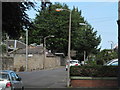
Prospect Bank Road
Dayburning high pressure sodium streetlight. This photograph was taken just months before these light sources were due to be replaced by LED fittings. A reminder of the days when streetlighting was shades of yellow and gold rather then pure white.
Image: © Graeme Paterson
Taken: 24 Jun 2020
0.04 miles
3

Restalrig Road Bridge
The view of the bridge which takes Restalrig Road over the disused Caledonian Railway line from Seafield.
Image: © Sandy Gemmill
Taken: 26 Apr 2007
0.06 miles

5

Torino, Restalrig Road
Formerly The Tor and currently for sale.
Image: © Richard Webb
Taken: 5 Jun 2024
0.06 miles
6

Restalrig Allotments
View through the fence from the railway path.
Image: © Richard Webb
Taken: 24 Aug 2023
0.06 miles
7

Drying green, Restalrig Circus
Gate onto the railway walk is locked.
Image: © Richard Webb
Taken: 24 Aug 2023
0.08 miles
8

Seafield Branch trackbed
Now the Restalrig Railway Path, this was a loop around Leith giving the Caledonian Railway access to Leith Docks.
Image: © Richard Webb
Taken: 24 Aug 2023
0.08 miles
9

Barleyhill Terrace
The older building at the end was once mapped as an "industrial girls school"
Image: © Richard Webb
Taken: 28 Dec 2023
0.09 miles
10

Restalrig Railway Path
Flats on Restalrig Circus, there are allotments on the opposite side of the former railway line.
Image: © Richard Webb
Taken: 24 Aug 2023
0.10 miles